Featured

Pakistan – behind the headlines: (1) Lahore

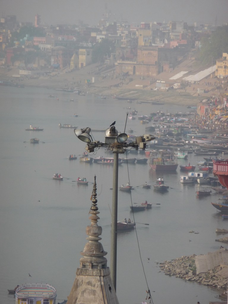
It’s not on everyone’s travel list. In the West, the word alone conjures up images of military coups and political assassinations – Benazir Bhutto’s may be the most recent and most famous, but Pakistan’s been at this since it was four years old. Then there’s Abbottabad, the last refuge of Osama bin Laden; support for the Afghan Taliban; the on/off nuclear standoff with India; the ongoing dispute over Kashmir.

And it wasn’t really on my list either until I met Barb in Oman a few years’ ago and heard tales of her month-long trip there earlier that autumn. Until I saw her pictures.

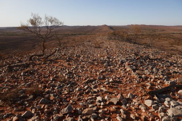
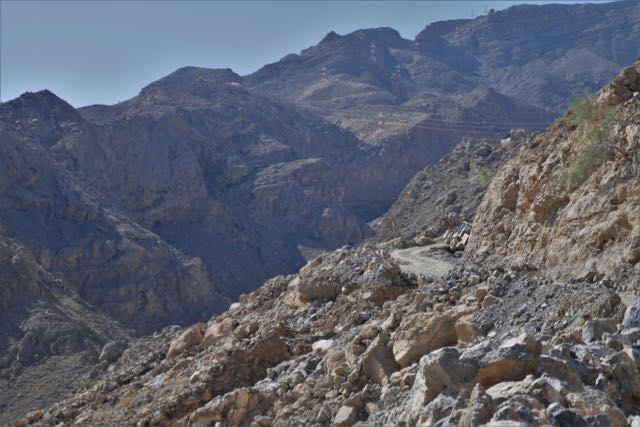
“Spiky mountains,” said my brother dismissively, pushing me for a reason for my latest trip. “Haven’t you had your fill of spiky mountains?”

Clearly not.

Badshahi Mosque and its feline residents

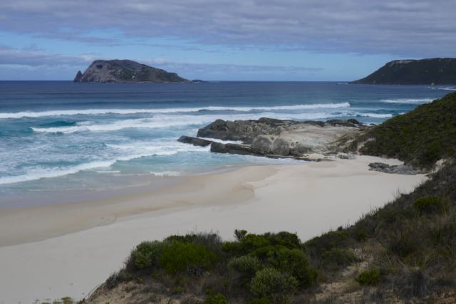
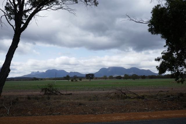
On my return, there were the usual questions, “So how was your trip? What was it like?”. How do you condense a new country-experience without your audience checking their watches? When it ranged from exploring on my own to the ebullient and crowded celebrations of a pagan festival; from the plains of the Punjab to yes, some very spiky mountains (and these were only the fringes of the Hindu Kush); from Gandhara to the Mughal empire, and the all-too-recent agonies of Partition?

In a word: friendly.

The imposing Pakistani Rangers at the Wagah border crossing with their beaming “Welcome to Pakistan” as they opened the high iron gates just wide enough for me and my luggage cart to squeeze through.

traffic chaos near Shahdara

On the overcrowded metro-bus in Lahore, a gaggle of young women counselling me with assured advice and posing tentative questions as the vehicle lurched along the overpass. Among them, the newly married Fatima. Enchanted to hear I’d visited her alma mater, Kinnaird College, earlier that morning on behalf of a reminiscing friend who’d worked there before Fatima was born, she insisted on negotiating and paying for my onward tuktuk to the Mughal tombs of Shahdara Bagh.

The street seller in Peshawar insisting on our trying his speciality kebabs – with two of us vegetarian, it was the ever-obliging Alex who stepped forward – yet refused all efforts at payment.

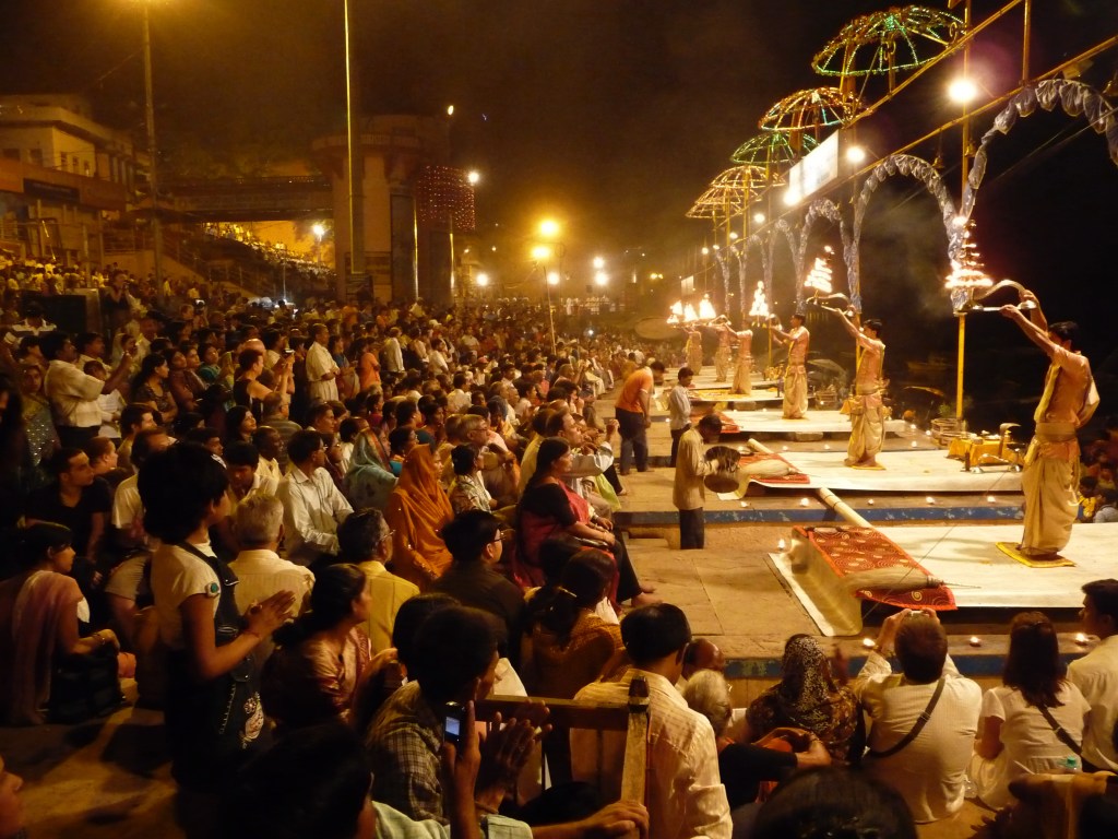
And, above all, the all-embracing warm hospitality of our hosts, welcoming us like family, and the people of the Kalash village of Balanguru when we joined them for their winter festival of Chaumos.

Our Swat Valley police escort’s formality melting away when the cameras appeared and our glamorous Terri asked for a selfie. At each district border, the old escort would wave us cheerfully on our way as the new one took up position.

Waiting…

But Pakistan wasn’t an instant love affair, I admit. Crossing over from Amristar was tiring, albeit less than 60km away, and my Lahori hotel abutted a major thoroughfare, which, with streetlights sporadic and pavements non-existent, did not seem close to any obvious dinner options. I find land borders exhilarating – the timelessness and raw exposure of walking between border posts, the unpredictability of the process (my papers must have been checked six or eight times on the Indian side, and a polio vaccine administered for no obvious reason) – but they’re not without a modicum of stress and a whole lot of waiting around, though there can be unexpected moments of humour. This time it was the Pakistan immigration official, who emerged from his office to say he was in the middle of his lunch; please could we give him half an hour? “No” wasn’t an option. The three of us – myself and two Pakistanis – sat down obediently.

The Fasting Siddhartha

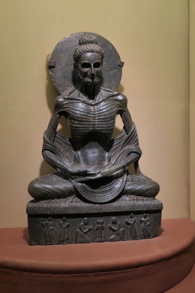
The next morning, Lahore’s pollution and noise reminded me of India 25 years’ ago, and the prospect of a couple of days here seemed daunting. But my first stop, Kipling’s “Wonder House” (I was re-reading “Kim”) – albeit now a few doors further up the road – worked its magic. The Lahore Museum’s series of high-ceilinged cool halls feature displays of artifacts dating back to 7,000 BC, as well as comparatively more recent finds from the Indus River civilisation and the Gandharan empire. One of the Museum’s most notable pieces is the Fasting Siddhartha from the second century AD, but its emaciated form left me cold and somewhat revolted. Instead, I thrilled at the sight of the ancient Qur’ans, one being almost 1,500 years old, and many written in both Persian and Arabic, their glorious flowing calligraphy interwoven in different colours. Several school groups were visiting, little flocks of chattering uniforms, including a trio of be-phoned teenage girls who accosted me, giggling behind their niqabs, and politely firing questions in carefully poised English. It was tricky to know who had spoken, so my glance skittered around as I replied, and I was reminded – one of the lessons of covid – quite how much expression the eyes alone can convey.

Kim’s cannon

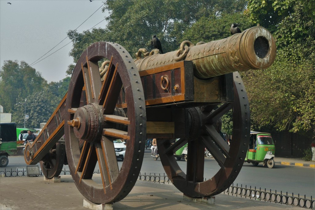
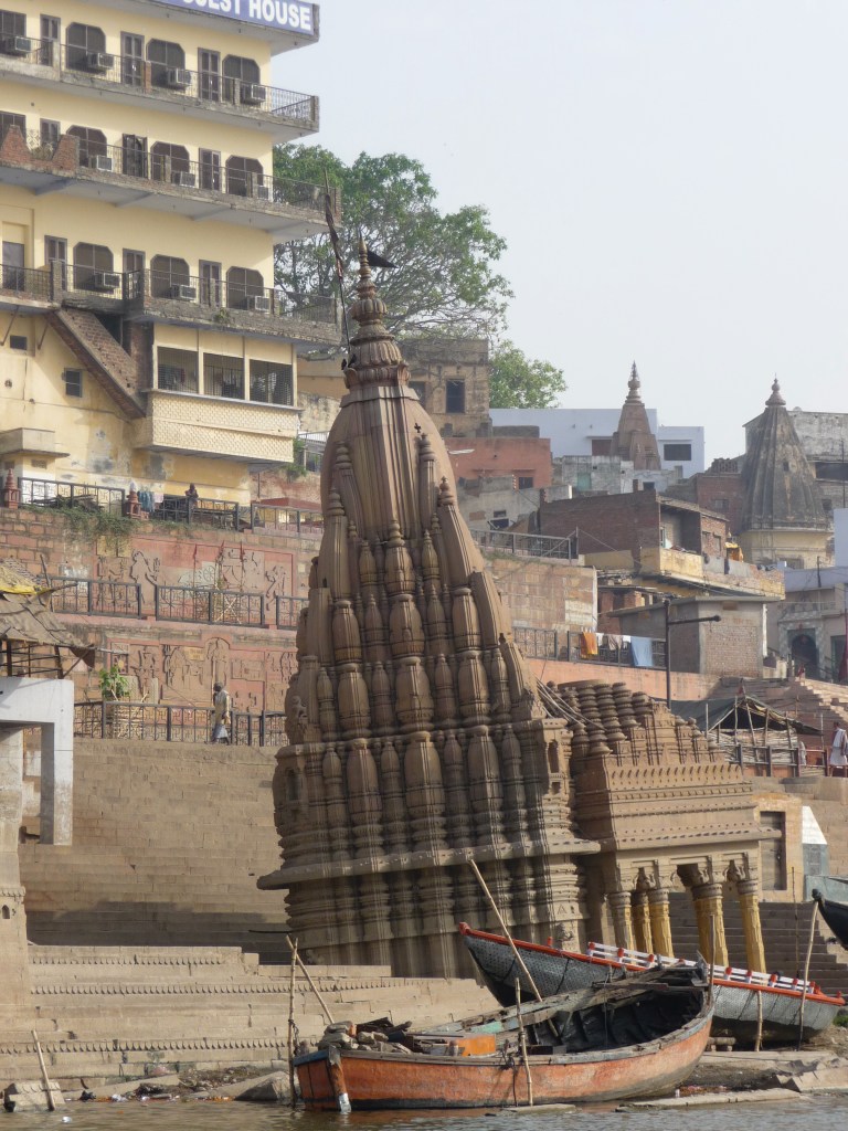
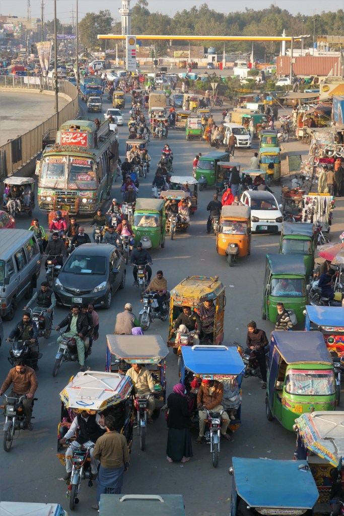
Kim’s cannon is now sadly fenced off and stranded in the middle of six lanes of traffic. After all, the story goes that whoever controls the cannon controls the Punjab, so some degree of precaution would seem to be desirable. Having taken my life in my hands to cross the road, I ducked into the maze of narrow streets that comprises Anarkali Bazaar, and made my way towards the Walled City – where I found a Lahore I could love.

Peek-a-boo!

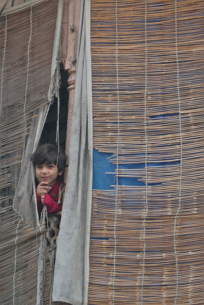
Strolling through the Bazaar, let alone the even narrower and winding streets within the Circular Road that protects the old town and innermost Walled City, is not for the faint-hearted. Traffic can approach from every direction, the “rules” of the road being more of a “guideline”, particularly in the minds of mopeds and motorbikes. But, if you stand for a moment – with your back against a wall for safety’s sake – and look around, it is hugely rewarding. No two buildings are the same. Old carved wooden balconies still cling to upper floors. Electric wires form a cat’s cradle of chaos not much above head-height. Domed cupolas and stone archways give a glamour belied by the building’s appearance at street-level. A wee boy sneaks a peak from between bamboo blinds two floors above. Stalls show specialisations that defy commercial logic: can one really make a living selling yellow HB pencils?

Jahangir Quadrangle, Lahore Fort

Within the Walled City’s imposing ramparts, a calm descends, traffic kept safely at bay. Here are two of the jewels of Lahore: the Fort with its welcome expanse of green parkland around and between imposing Mughal buildings in varying states of renovation; and the stunning Badshahi Mosque with its impressive, stepped approach leading up from the geometric formality of the Hazuri Bagh – where emperors would review their troops and hold court – to its grand red sandstone gateway. Apparently, its courtyard can hold around 60,000 people, which would dwarf Delhi’s Jama Masjid. That afternoon, there was just me, an earnest group of madrassah students, and a female cat overseeing her offspring’s explorations. Outside, I sat on the grass and drew breath, while a small convocation of eagles descended and pecked away at the ground nearby, seemingly oblivious to their surroundings.

Minar-e-Pakistan

On the far side of the old city, modern Pakistan makes a dramatic re-appearance, with the Eiffel Tower-esque Minar-e-Pakistan dominating the sprawling but well-kempt Greater Iqbal Park. It marks the place where, while European interest was focused elsewhere, the All-India Muslim League passed a resolution calling for the creation of an independent Pakistan, the first official demand for a two-state solution to the looming question of British India’s future. Muhammad Iqbal, a major figure in the Muslim League and the man behind the name – of the country and of the Park – is buried in the Hazuri Bagh, though access to his tomb was blocked off by restoration work when I was there.

Masjid Wazir Khan

As the sun began to set, I meandered back through the old city’s rabbit warrens, now bustling and lively with evening markets, and tripped over what may well now rate as my Mosque Of The Century, the Masjid Wazir Khan. Escaping the tarpaulin-covered alleyway where I’d been dazzled by the colour, sequins and mirrorwork of the clothing on display, I found myself looking up at a red sandstone minaret whose octagonal sides were punctuated by what, at first glance, appeared to be more of the same sparkling colourful fabrics I’d just been admiring. The Masjid’s tile panels are glorious, many outlined in gold and featuring, as far as I could see, every colour under the sun. The courtyard in front of the main entrance is a little below street level. In the evening, divans and tables are laid out and street sellers display their wares under the arches, making for an unexpectedly cosy and convivial setting. Of course, like much of what I would see in Lahore, it will be wonderful when the restoration is finished, but it was heartening to see so much work going into preserving the country’s heritage.

Badshahi Mosque

That evening, I treated myself to dinner on the top floor of the Haveli Restaurant on the aptly-named Food Street. This was Biryani With A View, a stunning outlook over the floodlit Fort and Badshahi Mosque. Having not managed to get back to my hotel beforehand, I was bothered I might be cold – but, unsolicited, a dish of hot coals was placed at my feet. A beer would have topped it all off, but “when in Rome” and all that…

The next day, I crossed the Ravi River to Lahore’s northwest to visit Shahdara Bagh and the mausoleums of the Mughal Emperor Jahangir, his wife Nur Jahan, and her brother Asif Khan, better known as the father of Mumtaz, the lady in whose honour the Taj Mahal was built. Here, once my tutktuk had left the manic chaos of the multi-laned highway beside the metro-bus terminal, was something more akin to rural Pakistan; I’d left the big city behind, at least for a few hours. Here were people’s lives – children playing in the street, a bicycle invisible under its massive load of bamboo, men walking home along the railway line – and deaths, a graveyard, cheek-by-jowl with life.

Jahangir’s tomb

While Nur Jahan’s and Asif Khan’s tombs were in the middle of some much-needed work, Jahangir’s was, befittingly for the emperor, stunning. Featuring the same pieta dura work as the Taj Mahal (Jahangir’s successor, Shah Jahan, was responsible for both monuments), his tomb is housed in a large square building with minarets at each corner. Marble inlay decorates the red sandstone walls, whereas the minarets are themselves of marble, with geometric patterns in inlaid stone. When I returned to my boots – shed for the purpose of visiting the tomb itself – one of the guards pointed up with a questioning look. With the air of a Le Carré spy, checking over his shoulder, he escorted me round the corner and unlocked a door, motioning me in, up, and then further up. Barely one-person wide, the narrow staircase took me to the top of the minaret and a glorious view. Looking back towards Lahore, blue faded from the sky, killed off by pollution, but on my side of the river, the colours were fighting back.  

view from the top of Jahangir’s tomb, Shahdara

My final stop was the Shalimar Gardens. I nearly didn’t go. Daylight was fading by the time I’d navigated my way there – tuktuk, metro-bus, and a second, much longer, tuktuk ride in what I presume was rush hour (aka even more insane traffic) – but the reward was enormous. Once again, Shah Jahan has left his mark in wonderful style. The gardens complex is vast, laid out geometrically in a series of terraces, each higher than the last. I trudged through the square gardens of the first terrace thinking blasphemously that it wasn’t anything special, particularly as the fountains and water features weren’t working, but then I reached the central level reserved for the emperor’s harem. And found myself in a Bollywood filmset, or so it felt. Below the marble balustrade at which I now stood, fountains teased the dying light, the colours of the sky reflected in the ornamental lake. A bridal party was having photographs taken on a marble platform in the centre. Kids played, couples courted, and Lahoris enjoyed a few minutes away from the hustle of life. I meandered around, hypnotised by the timeless beauty of my surroundings. Only the disappearance of the sun prompted me to more prosaic thoughts of my hotel and food.

Eagles at Lahore Fort

That evening, I returned to the restaurant I’d eventually found my first night, and happily tucked into the best barbecued fish I think I’ve ever tasted.

The next day I was to head north to Islamabad up the N5, more romantically known as the Grand Trunk Road. Ending, as I’d started, with echoes of Kipling.

Featured

The beating heart of India

view upstream from my room

Varanasi is not to everyone’s taste, I discovered, canvassing both European and Indian views in advance.

“I didn’t like it… but then maybe we were tired. It was the end of five weeks’ rushing round India,” one travel-addict friend told me apologetically.

“It’s pretty intense,” said another, grimacing.

“Varanasi is great… enjoy it – it’s full-on India but I know you will be unfazed by it!” wrote an expat Brit in India.

“It’s how I imagine Westerners feel on visiting India for the first time,” said Radhi.

looking downriver from Hanuman Ghat

“But it’s filthy and dirty, how could you possibly enjoy it?” shuddered Kavita into her cocktail.

Varanasi, I concluded, even before the plane touched down, would be India Concentrate. For me, India fascinates, bemuses, enchants and frustrates, much like an errant or wilful but precocious child. She can be full of surprises when you’re least expecting them; she can be recalcitrant and determinedly obstreperous. She’s a joy and a heartache. She has a beauty far beyond the best photographer’s abilities, and she is unspeakably filthy. She is growing and developing, yet she is rooted in a past that goes back further than Western memory.

kids will be kids the world over

Varanasi is all of these. A story, a multitude of stories, in every frame, in every view, in every image.

Scuttling through the galis – the winding alleyways – of the old city in pursuit of my holdall, raised aloft my taxi driver’s head, and wondering how I’d ever find my way out again, I gagged on the smells, vowing to find myself a lightweight scarf to mask my face, as many of the locals do. I wouldn’t be wearing flip-flops here, I thought delicately: I’d rather my feet be protected from whatever was underfoot, solid, liquid or squelch. Yet around me were blasts of vivid colour, women’s saris, silks for sale; above me, fleeting snippets of history, an ornate temple tower, a carved mantle, a wrought-iron balcony. Smiles of welcome, stares of curiosity.

gali debauching onto the ghats

After what felt like an age in this maze, we were spat out and I found myself at the top of a flight of steps leading down to Ganga Ma, the great Mother of India, the River Ganges. Below, a jumble of people thronged her waters, their voices echoing up to me. Beyond, the floodplains, startlingly denuded of construction and, at first glance, unexpectedly empty of life: a stark contrast to the hubbub on this side of the river.

ghat-cricket

Everything, but everything, happens in and beside the Ganges here during daylight hours and well into the night. Morning ablutions decorously effected under saris and dhotis; teeth scrubbed with fingers or twigs. Playtime for kids racing each other in splashy swims across the river. A cool dip in the heat of the day, an open-air Turkish bath for groups of men relaxing briefly from the toils of getting on in their lives. Dogs patrolling the riverside detritus, barking and fighting over spoils and territory. Stray cattle, a ubiquitous presence on the subcontinent, foraging amongst the garbage and leftovers on the foreshore. Games of cricket improbably taking place along the ghats, the iconic wide steps that form Varanasi’s riverfront: if the ball lands in the water, the batsman’s out, I was told, and some poor child jumps in to find it. Dhobi-wallahs washing and beating the city’s laundry against flat rock “wash-boards”, nauseatingly close to outflow pipes, and hanging it out to dry in serried ranks of matching items on the steps, slopes and railings above. Everywhere puja – personal worship – for the faithful, each supplicant alone in the crowds with their prayers and their offerings. And, at two dedicated ghats, funeral pyres, the last rites for the physical body.

dhobi-wallahs at work

If there’s one thing for which Varanasi is renowned, it’s the burning ghats: incredulous Western voyeurism at conducting in public what we prudishly consider a private ritual. Yet for us, it is simply about the disposal of the body, an alternative to burial or donation to science. In Hinduism, by contrast, the act of cremation itself is of huge spiritual significance, the means by which the soul severs its ties with the body and continues its quest for moksha, freedom from the cycle of birth and rebirth. Cremation on the ghats at Varanasi is the most auspicious, the soul achieving moksha without any further incarnation.

wood for pyres

That said, it’s also a practical matter. Wood is piled high in the galis around the ghat, brought in from across the river and even from across the seas, ready to be weighed on antique scales and carried down to a particular pyre. Different woods for different people, for different castes, for differing wealth. As a rough rule of thumb, I was told, a funeral pyre takes about 200 kg of wood and costs a minimum of 3,000 rupees. Electric cremation is much cheaper – 500 rupees – and quicker, but is not considered as effective at liberating the soul.

The body is wrapped in white cloth, laid on a bamboo stretcher, and covered in gorgeous reds and golds, before being carried high on shoulders through the galis, the alleys so narrow and twisting you can inadvertently walk straight into a funeral procession on turning a corner too abruptly (and I did, twice). Only the men of the deceased’s family and acquaintance are involved in this final stage of life; a woman’s tears are said to constrain the soul and prevent it leaving the body. On a practical level, it removes the opportunity for sati – the widow immolating herself on her husband’s pyre – which is now outlawed. Pyres are constructed by the Doms, a sub-caste of Dalits – formerly known as “untouchables” in India’s caste system – who meticulously manage the entire process. The body, once immersed a final time in the Ganges, is laid on top, and the pyre lit from an eternal flame that is carefully tended at a nearby temple. Burning takes three hours, I’m told – not because, I macabrely imagine, that is how long it takes to cremate a human body completely, but because there’s probably a queue for that pyre. Friends and relations stand by while it burns. It is said that a woman’s hips and a man’s chest do not burn, so these are thrown into the river for the fish to consume. Humans eat the fish, and so the cycle of life continues. Certain people are not cremated because they are considered inherently pure. They include sadhus (wise men), children under nine and pregnant women, and those who have died from snake bites, leprosy or smallpox, these conditions being thought to have caused such levels of suffering as to have generated the requisite degree of purity before death. At Harishchandra Ghat, people of any religion may be cremated; the main burning ghat, Manikarnika, is only for Hindus.

morning puja

And anyone who has spent any time at either of the burning ghats will be able to reel off the same information. It’s as if the locals are programmed with the same “Top Ten Facts About Cremation For Tourists”. Whether you are then persuaded to part with a few rupees in gratitude for this unsolicited information is up to you. Sunil, an engineering student at Benares University, emphatically did not want to be paid. “In India, many sad, bad, good, kind people,” he tells me philosophically. He says he simply enjoys meeting people and practising his English. After running through the Top Ten Facts, he takes me up to the balcony of a nearby temple from which, in the new darkness of the evening, I count no fewer than fourteen pyres burning, whether already “occupied” or not. When we return to ground level, he urges me to climb the steps to the topmost level of the ghat where only Brahmins, the highest caste, may be cremated. He brushes off my very British reticence – “Are we not intruding? Do the relatives not mind?” – as we skirt a very conspicuously occupied pyre, the body silhouetted against the flames. On the far side, the dozen or so men look oddly uninterested in the pyre before them. Blank-faced. In grief, in denial, or inured to the process?

the Sinking Temple, Scindhia Ghat

There is a curious atmosphere at Manikarnika Ghat. Perhaps it is its more confined location – at a bend in the river, blocked in by surrounding buildings and temples – that makes it the more intense of the two burning ghats to visit. Around me, spectators, tourists, relatives, workers, monks, dogs, cattle, those seeking a commercial opportunity… An urgent cry goes up: a particularly large and determined cow, calf in tow, is heading down the steps and the crowd scatters. A pyre flares, flames reaching a couple of metres into the air, and a camera flashes intrusively (an Indian tourist breaking the no-camera rule, I’m relieved to note, limiting my vicarious embarrassment). I ask Sunil why he and his friends come down to the burning ghats in the evening. “Because there’s always something going on,” he replies, pragmatically. This for the tourist, though, is the Varanasi Conundrum. In visiting the burning ghats, are we unwelcome voyeurs? Or accepted, tolerated, even necessary – because of our obvious commercial value? Are we also participants? Do we slip over from one to another?

our valiant boatman

For a different perspective and a welcome breath of fresher air, I took boat trips on the Ganges at both dawn and dusk. From the river, the noise and crowds are muted, and the city’s erstwhile grandeur stands out, many a maharaja and prince of note having once built ornate palaces along the river’s edge. For me, the morning trip is the more magical, watching the city slowly open its eyes to the coming day, gradually shaking out the sleep and warming up in the rising sun. The haze never really disperses here, its effect on the chaotic and built-up riverbanks, disappearing in the distance either side of us, is ethereal, emphasising the timelessness of this heart of India. Even the tourists in their boats are silent, the morning too new for conversation. A lone puja flower offering drifts silently past on the mirror-like surface of the river. Monkeys scamper across rooftops. A pigeon flaps heavily past, weighed down by a strand of marigolds rescued from an offering or a funeral pyre, now destined for its nest. The Ganga Supermarket approaches: a boat laden with tourist memorabilia is being paddled towards us, but the enterprising oarsman has no takers. A fisherman hangs his catch over the side of his boat to keep it fresh. A passing tourist reports a dolphin sighting – incredible that there might be any life in this river, pollution and all. We pause for a welcome chai, the hot sweet milky liquid disproportionately delicious at this hour of the morning, although the thin plastic beaker is so flimsy I have to hold it with both hands to stop it crumpling before I finish the contents.

ganga aarti ceremony at Dasaswamedh Ghat

In the evening, it’s all colour, noise and light, with the ganga aarti ceremony at Dasaswamedh Ghat the focus of attention. Tourist boats converge, looking, from the shore, like a water-borne refugee crisis. Candle offerings on banana leaves float flickeringly past. On land, the steps are crowded with spectators, the women’s saris and salwar kameez dazzling explosions of colour amidst their menfolk’s muted attire. Smoke from the lamps and intoxicating aromas from the priests’ incense waft over us. Drums beat rhythmically. The priests work in unison on their individual platforms as they ask the gods for blessings on us all at the day’s end. I can feel myself becoming lightheaded on the atmosphere and the hypnotic cadences of the chanting and the drumming.

combatting the pollution

Looking at the timelessness of the ceremonies in front of me that first evening, I struggled to believe that, only the morning before, I was drinking coffee at home in the chill of London.

In the twenty-first century.

Postscript: I wrote the original version of this blog in April 2010, but I amended it for submission to a competition run by TripFiction in November 2020 for short pieces conveying “a sense of place”. I was delighted to hear that I’d come in the top ten, with the competition attracting nearly 400 entries from 35 countries.

I love a sunburnt country…

I’ve been coming to this particular remote corner of New South Wales for over ten years, and I don’t think I’ve ever really given it the blog-space it deserves.  And so, please meet Fowler’s Gap, the Arid Zone Research Station run by Sydney’s University of New South Wales.  100,000 acres of not very much at all, and I love it.

paradise days at a billabong

To someone living most of the year on a cosy overcrowded little island, the prospect of flying for almost three hours and still not leaving the state in which you started is a little mind-blowing.  Such is the flight from Sydney to Broken Hill, the self-proclaimed gateway to the Australian Outback.  From there, the station is another 110 km up the road.  I joke back home that running out of milk here necessitates a three-hour round trip, and even that timeframe has only been possible in the last few years when the last couple of stretches of the road into town were finally surfaced.  Mobile phone reception here is negligible, as it is from about 10 km north of town, and broadband only very slowly improving.  A couple of years’ ago, I talked to the IT department of the large US bank at which I was then seconded about accessing the bank’s systems so that I could work from here, already knowing from experience that the usual log-in method was painfully slow, and trying to download documents or click on embedded links invariably crashed my computer.  “Tell your friend to get better broadband,” was the unimaginative response from New York.  Nowadays the broadband is good enough to watch Netflix, but I still can’t access my occasional-firm’s systems, not that, I have to admit, being technologically incapable of working here is something over which I lose any sleep.

hungry emu chicks at the door

To someone living in the maelstrom of London, the prospect of being surrounded by an awful lot of nature – views to the year-after-next from the top of the ranges that dot the property, fluctuating numbers and species of animals and birds – and very, very few people can be daunting.  I posted some kangaroo photos on Facebook one year, and got the comment back from one such London-based friend, “But where are all the people?”  Even a bush-toughened Africa-based tour guide and a friend whose life plan is to kayak vast stretches of the Australian coast on his own have asked me how I cope with the emptiness.  Yet it’s actually one of many reasons I love it here.  I can go for days without seeing or speaking to anyone else, not least because I’m usually here in the hotter months, outside peak research season. 

GPS-tagged echidna

“But what do you actually DO out there?” is something I’ve been asked more than once.  First up, I read prodigiously, devouring so many books that I decided this year to bring with me some of the weightier (at least in terms of content) tomes lurking on the shelves of my to-read bookcase as those poor shelves are now overflowing.  More virtuously, I catch up on work-related know-how, and any outstanding blogs and travel-related admin.  Occasionally, I get roped into station activities, and have happily helped out on projects relating to kangaroos, feral cats, small mammals and echidnas, as well as participating in student and staff parties (not exactly a hardship).  One memorable Australia Day, we got together for the mandatory barbecue late in the afternoon as the mercury had topped 40C (105F) that day, and played cricket with the station manager’s kids, watched over by the latest collection of young orphan kangaroos:  you don’t get a much more “Australian” experience than that!  I’ll also do sporadic re-supply runs into Broken Hill, and pick up or drop off students and researchers, and I keep my “detail” eye in by proofreading the occasional paper, report or thesis chapter.  But most of all, this is my switch-off and recuperation time, replenishing batteries worn a little thin by my hectic London and Edinburgh work and social lives, and wherever my most recent travels have taken me.  If I can’t actually have the nine-lives quota of a cat, I’m doing my best to live several at once, and here is where I catch up with myself.

view along the Twin Tanks ridgeline

But I have it easy, I know.  I drift in and out of Fowlers Gap during my annual escape-the-British-winter sojourns in Australia;  I don’t have to live here.  And it is particularly brutal at the moment, in the midst of what an increasing number of the cognoscenti are calling the worst drought on record in Australia.  (With records only going back 130 years or so in this part of the country, that may not be saying very much, but it’s no less painful for those battling it in the here and now.)

a dry creek bed becomes a raging torrent

I’ve been here when the views are green, pasture for the resident sheep, kangaroo and goat populations abundant, grass so long in the middle of the tracks that you have to check the front of the vehicle periodically for seeds and detritus, and the dams are filled to overflowing.  Ducks and geese appear, pot-loads of yabbies are caught for the station barbecue, and scientists start talking about researching fish.  In a downpour, the usually-dry creeks become almost instant torrents, and, here on the homestead, we’re cut off from the main road;  oftentimes the road into town is closed as well because of the number of creeks that gush across the road.  Rare water flow means there’s little point bridging the dozen or so creeks between here and Broken Hill;  marooning communities like ours for a few days is the infinitely cheaper option.

drought has its own beauty

But now I’m here for the third consecutive year of a very different Fowlers Gap.  A range of colours that Dulux might label “Terracotta Chip”, “Show Business” and, appositely, in more ways than one, “Red Terra”.  Green is a luxury only afforded to those trees still surviving in the dry creek beds, and to the station manager’s lovingly manicured front lawn.  Indoors, there’s a constant battle against the dust.  However good the insulation of the accommodation – and it isn’t – not much can withstand the Outback’s dust.  It doesn’t even need an apocalyptic-looking dust storm, though we’ve had those earlier this season; any wind from the west or north, blowing over achingly dry land before it reaches us, brings more. 

a pair of Western greys in greener times

I’ve been here when the flat country is almost alive with kangaroos, the hillsides dotted with groups of feral goats, the sheep plump and woolly, the prevalence of rabbits raising talk of reintroducing controls, and even the occasional fox and feral cat looking in good shape.  This year we came back to the station after a month’s break to find one dead euro (a type of small kangaroo) outside the house; last year, there were three.  I’d commented wryly to folks back east that I didn’t think there would enough animals left for there to be any dead waiting for us this time.  I walked over to the Twin Tanks lookout last night – maybe a 90 minute round trip if you stop to enjoy the views and come back along the creek bed – and the only kangaroo I saw was close to the house; more likely one of the hand-reared orphans gone temporarily AWOL from its cosy gig at the farm manager’s house where, along with several dozen others, it is fed and watered regularly.  The enclosure in the homestead into which these orphans are “soft” released when mature probably now houses as many kangaroos and emus as are wild across the whole property.  As you walk around, there are occasional waves of the sickening smell of decay, the only positive that can be dredged out of this being that more animals have lasted until now than I’d expected.  White bones are all that’s left of those that didn’t make it this long.

a dust devil

This is the raw reality of drought.  The average annual rainfall here is approximately 230 mm, yet the sum total of the last three years’ rain barely reached 75% of this annual figure, having been, respectively, 84 mm, 48 mm and 42 mm.  The station’s most recent quarterly report is stark: “There is now no grazing and only a little browse remains.  Saltbush and other shrubs have been reduced to old growth stems and river red gums have started to die in the riverbeds.  All dams are now empty.”  And that was over four months’ ago; only 1.6 mm of rain has fallen since.

Those with an optimistic frame of mind say phlegmatically, “Each day without rain is one day closer to the day it rains,” although I fear this adage may be wearing thin.  But I keep going back to the wonderful Australian classic, “‘We’ll all be rooned,’ said Hanrahan”, an ode to the weather grumbles of every farmer. 

Austalia’s icons being looked after on station

“‘We’ll all be rooned,’ said Hanrahan in accents most forlorn,
Outside the church, ere Mass began one frosty Sunday morn.
The congregation stood about coat-collars to the ears,
And talked of stock, and crops, and drought as it had done for years.
‘It’s looking crook,’ said Daniel Croke; ‘Bedad, it’s cruke, me lad,
For never since the banks went broke has seasons been so bad.’”

Of course, it then rains, but our hero is still worried: “‘We’ll all be rooned,” said Hanrahan, “If this rain doesn’t stop.’”  Sure enough, the rain does stop, the grass grows, and another concern emerges:

Sturt desert peas, a reward for surviving the bad times

“‘There’ll be bush-fires for sure, me man, there will, without a doubt;
We’ll all be rooned,’ said Hanrahan, ‘Before the year is out.’”

Brutal as this is, it is part and parcel of the Australian Outback. 

And the rains will come.

the homestead complex in good times and bad
view over the flats in good times and bad

In (one or two of) Thesiger’s footsteps – part III

first campsite in the Empty Quarter

“I was exhilarated by the sense of space, the silence, and the crisp cleanness of the sand.” 

Thesiger put it in a nutshell. 

endlessness

Sometimes, I find, the places that have the deepest impact are the hardest to describe.  The next morning, I stood at the top of the smallish (75m/250ft) dune behind our first night’s camp in Rub’ Al Khali and tried to grasp the fact that this stunning, terrifying, hypnotising, incredible landscape continued in front of me for another 500km (310 miles), and stretched the same distance to either side of me.  Even today, all of the Empty Quarter crossings made by non-resident explorers can be summarised in little more than a single screen of a Wikipedia entry, and, even now, all the technology in the world cannot insulate the visitor from its dangers.  We were warned the first night to take extra precautions at night.  Don’t go too far from your tent.  Follow your own prints back to your tent; don’t be tempted to take another route back.  If possible (because torchlight does not illuminate footprints at all well), leave a light on in your tent so that you can find your way back (thank goodness for mobile phones’ torch function).  We heard of one girl who didn’t follow the rules, and her absence was only noticed two hours after she had left her tent.  She was found several hours’ later over 20km away, being cared for by passing Bedouin, just before the tour company called out the army to look for her.  This land has enchanted the imaginations of fiction-writers, movie directors and even computer games designers;  it is brutal, wild and beautiful.

footprints and ripples

We were to have two nights’ camping in the Empty Quarter.  It is day-trip-able from Salalah, though that would be a long day and you’d barely get into the dunes, and some tours offer one night’s camping.  Two nights would allow us time to get a little further into the desert, time to visit an oasis, to climb more dunes, to listen to more near-silence, to ponder further the enormity and beauty of our surroundings, albeit we would still only be scraping the surface.  Our trip would not be added to the Wikipedia entry.

flickering twigs

While the dunes themselves are almost bare of vegetation – the Quarter’s average annual rainfall is only 35mm (1.4 inches) – the gravel and gypsum plains in between are dotted with scrubby plants that more resemble bunches of bare stalks than anything deserving of a grander label, though one or two had fragile little yellow flowers.  Although not much to look at, these plants could nevertheless harbour flies, so Nawaf was always careful to choose for our night’s camp a flattish area as devoid of bush as possible.  When we planned a bonfire one evening – largely so that the Canadians could show us THE way to roast marshmallows (who knew it was such an art form?) – we optimistically gathered some of this scrub for kindling, but it was too small even for this purpose, and simply lit up in momentary twiggy incandescence.

Our full day in the Quarter started with a brief drive into the nearby town.  Al Hashman was as sterile a place as Muqshin had been the day before, pristine new buildings but very few people, though a group of camels, including some rare black ones, were tethered picturesquely outside town suggesting some Bedouin were around.  We were told we could photograph the animals, but not to step out of the cars to do so because this would upset the Bedouin who would assume we were about to steal the camels – regardless of how improbable and impractical this idea might seem to us with our overloaded vehicles.  Camels are to the Bedouin what cattle are to the Herero in Namibia and the Maasai in Kenya.  Apart from being transport, and a source of food (meat and milk products), drink (milk and occasionally blood), wool and leather, they are important for entertainment – camel-racing, a traditional activity now upgraded, regulated and transformed into a highly competitive professional sport under the aegis of the long-reining Sultan Qaboos bin Said – and culturally, with brides traditionally being valued in terms of camels.  (One of my compatriots tried to “sell” me to Nawaf for 2,000 camels.  “OK… but not racing camels,” Nawaf countered with a grin.)  Camels appear to roam wild across much of the country, but each one will have an owner.  We even saw an advert at a petrol station for GPS tracking devices for camels (even if we had originally interpreted the poster as being a MISSING CAMEL notice).

distant camel

Back amongst the dunes we drove for an hour or so around the edge of a gypsum valley, the mineral staining the land’s surface white in places, before we stopped part-way up the side of the valley to indulge the shutter-fingers.  It was hard to take it all in.  Wind-wrinkled red sand, leached-out colours in the strength of the midday sun, false 3D patterns created by the varying gradations of colour in the sand, dunes so large that they themselves are the culmination of undulating smaller dunes. 

modern-day oasis

We lunched at an oasis, but this was no Hollywood film set with palm trees and a tranquil pool.  Here the water is hot and sulphur-smelling, pouring out of the ground with manmade assistance into a huge cement-sided bath, surrounded by shady not-palm trees.  A gaggle of cars was already gathered as we drew up, an extended family from Salalah enjoying the long weekend.  While the Welsh artist and I went scrambling up another dune, and Nawaf, Idris and Ahmed cooked up a delicious lunch, the others got talking, though more in gestures and smiles than language.  Clearly a connection was made because, no sooner had we finished our own lunch, declining third helpings, than our oasis-companions presented us with a large platter of rice and goat.  To my friends’ credit, they managed to squeeze in a little of the gifted food, and, in consultation with Nawaf, a return presentation of comestibles was made.

sand patterns

On the far side of the valley, the boys decided to show what the cars could do – or what they thought the cars should be able do, Idris having to let down his tyres still further in order to join the other two vehicles two-thirds of the way up one of the largest dunes we had seen.  It was maybe 300m in height.  Not even Ahmed could persuade his car to the top, and I would have been tempted to scramble up the rest on foot for the view over the other side, but the sand, in the early hours of the afternoon, was almost too hot even through footwear.

hypnotising

We backtracked a little in the afternoon, enjoying the same dune-scape from a different angle, with different light upon it, and now with shadows lengthening, before we turned into the dunes again, Nawaf searching for the perfect camp spot once again.  An element of dune-fatigue was setting in.  This is vast, indigestible landscape, and the thought of not being bounced around and having the chance to stop and enjoy it, drink it in, was becoming more and more appealing.  Finally, Nawaf declared himself satisfied, and, for one last time, we picked up our tent bags and pitched camp.  I left the Canadians to host their usual evening “soirée” with that day’s car-buddies (they had been generous in sharing their wine each evening on what had been nicknamed “the patio”, a group of chairs outside their tent), and went to climb up one more dune.  Given the height of the dunes around camp, the sociable folks missed out on the sunset which had been cloud-shrouded as it dipped behind the far side of the valley, but I was treated to a desert spectacular from my lofty perch, the sun seeming to stretch, grow and even bifurcate as its light refracted around the altostratus.

Cheesman’s gerbil

That evening we were joined by some exceptionally cute wildlife, although not all of us felt the same way.  We’d first encountered Cheeseman’s gerbils the night before, remarkably fearless and pretty creatures who would scurry around our feet, Idris’ cooking area, and any tents that had any suspicion of food inside.  But they weren’t to everyone’s taste, mice-like critters having that effect on some people.  A variety of coping strategies were adopted:  sitting cross-legged on the chair with feet tucked underneath, putting on enclosed shoes, and in the best example, putting on pyjama bottoms with the ends tucked into some very brightly-coloured socks.  Nothing seemed to put the gerbils off, though they might have needed sunglasses to cope with Peter’s leg-wear.

dune’s ridgeline

The next morning, the desert seemed to reflect our mood.  The sky was overcast in a might-be-a-dust-storm/might-be-rain/might-just-be-fog fashion, and the temperature had dropped.  Nawaf and his colleagues took longer to pack up the vehicles than usual because this time they were packing for the long haul:  most of this stuff would not be unpacked until they got back to Muscat three days’ hence, yet our luggage, and the bits and pieces we’d acquired along the way, had to be accessible for our forthcoming nights back in town and our flights out.  We sat around the table feeling a little out of sorts, with half-hearted attempts to play the word games and quizzes to which we had not before had to resort as conversation had flowed so constantly.  Our Scottish retired-GP companion was revealed to be a yoga instructor – if we’d known that earlier in the trip, she could really have kept us in shape for those long days of cramped-up driving (perhaps she deliberately hadn’t admitted this skill until now) – and put us through a few paces before we felt self-inducedly guilt-tripped into helping with the last stages of the packing up.

sunset through frankincense trees

And so we left the desert for a gradual return to civilisation.  Appropriately enough our route would take us through the site of various former civilisations:  ruins of what is suspected to be the lost city of Ubar, a desert version of Atlantis, believed to have been swallowed up by the sands (although, like Atlantis, it’s not clear if Ubar ever actually existed);  Sumhuram, thought to have been an important internal trading centre for southeast Arabia between 400BC and 200AD;  and Al Baleed which saw human settlement from the third millennium BC through to the Islamic period.  If I had missed out on standing in Marco Polo’s footsteps at Qalhat’s Bibi Maryam Mausoleum, I could do so in Al Baleed, described by the Italian as one of the biggest harbours of the Indian Ocean.  The reason for so much former activity in this area?  Sap that was once valued more than gold, and which has traded here for over 6,000 years:  frankincense.

distant oasis

In (one or two of) Thesiger’s footsteps – part II

Wahiba Sands

We had stopped in Sinaw earlier in the day, primarily so Nawaf, Ahmed and Idris could shop for the next few days’ provisions.  Sinaw has the raw-ness of a border town, which in a sense it is.  It is here that the Bedouin come to trade their camels, stock up on modern amenities, and sell their crafts to the few tourists who make it this far.  Sadly, it wasn’t camel-market day when we were there, though there was a solitary animal “parked” by the near-empty arena, cheek-by-jowl with somewhat less photogenic 4WDs.  Wandering around the main souq, we encountered Bedouin women wearing a variety of burqas – not here the mesh-faced, body-covering sky-blue garment of Afghanistan, but a form of face mask, originally designed in pre-Islamic times for sun and sand protection.  I’d first seen them in the Musandam when a group of abaya-clad young women were disembarking from a boat trip, and the exaggeratedly moustached appearance of two of them caused me to do a double-take.  Here the burqa (or batula) has made the transition from traditional garb of the nomadic Bedouin to fashion item, although many modern designs have their origins in specific tribes and regions.  It may cover as much of the face as the niqab;  it may simply outline the upper face in a delicate double-square whose midline runs down the nose and whose lower edge flares over the top lip.  I’ve even read that some are designed to mimic the falcons that Bedouin men still occasionally use for hunting, beak-like over the nose and rising to a peak above the forehead.  With heavily kohl-lined eyes, the effect is dramatic.

camel and car parking, Sinaw

But time was getting on.  I negotiated the purchase of a colourfully brocaded key ring, declined the opportunity to have my own eyes lined in kohl – the sharp metal implement with which she was gesturing towards my face looked a touch alarming – and joined the others in piling back into the three vehicles.

Nawaf had been relaxed about the wearing of seat-belts in the back while we were on tarmac or dirt roads, but now we were in dune country, and we had some distance to cover before nightfall.  As we had first witnessed in the scamper up the mountainside after our wanderings around Al Hamra, Nawaf was always keen to get us a great sunset.  Everyone hurriedly buckled up for a drive that at times reminded me more of quad-biking the grey dunes outside Namibia’s Swakopmund than the average overland trip.

mesmerising patterns

Sand dunes move.  We all know this in theory, but here we were seeing it in action, or at least dealing with its effects.  From satellite images, the Wahiba Sands look like a narrow fan of near-parallel dune ridges, but this suggests a misleading degree of order.  This was Nawaf’s first time here this season, and the tracks took some finding.  Occasionally he would stop and ask another vehicle or a bored guard at one or other of the few semi-permanent tourist camps, and occasionally we did a bit of improvised cross-country.  No need to worry overly about causing damage to dune structures here.  A breath or two of wind would soon wipe out all evidence of our somewhat irregular passage.

Wahiba Sands mosque

The sands were bewitching in their endless patterns, and we clamoured for photo stops.  A vista of reddish crests and slopes largely devoid of life stretching away in every direction, the colour changing with the shifting clouds and sunlight;  nearer at hand, sand-slips from ridgelines, and wind-waves exaggerated by darker and lighter colours of sand;  in the distance, a camel silhouetted against the late afternoon sky, and a mosque improbably solid amidst this shifting terrain.  The next morning, an intriguing collection of tracks around our tents suggested small mammals and lizards had been having a ball while we slept.  Our resident serious-amateur photographer wasn’t the only one with his finger on the shutter.

dinner

The next day, we had a very different Bedouin experience as we made our way down the coast.  I’m told that many Bedouin regard fishing as tantamount to begging, but in this particular region of Oman, the fishermen themselves are Bedouin, as soon evidenced by their ramshackle and temporary-looking villages around the top of the beaches.  Yet this is modern fishing, with 4WDs to launch and land their boats.  A little boy entertained himself – and, inadvertently, us – as he scampered in and out of the waves.  Later, his grandfather came over, bearing a gift as a thank you for our interaction with the lad:  a somewhat dauntingly large cuttlefish which the ever resourceful Idris (nicknamed “Mama” by his colleagues) would later turn into stew to supplement our dinner.  Our Scottish retired-GP companion was given the chance to hold the cephalopod – illustrating, with the grandfather’s help, the tenacity of the grip of the animal’s tentacles – and was heard muttering afterwards, “Its eyes, I looked into its eyes…”  They were certainly hypnotic, but not sufficient to prevent her sampling a little of Idris’ stew that night.

taking the boat out of the water, Omani-style

While I’d found the north and Muscat itself to be impressively litter-free, it was not the same down the coast, much to the distress of Nawaf who seemed to take the slovenly-ness of his countrymen as a personal affront.  However, the tides were also to blame, bringing onto Oman’s Arabian Sea beaches detritus from across the water.  Whatever the cause, it was particularly sad in this age of hyper-plastic-consciousness to see every stretch of sand above the high-water mark covered in plastic bottles.

setting up camp in the Al Khaluf dunes

Camp that night was supposed to be on the beach, but, instead, Nawaf found us a perfect site nestling behind the outer row of white dunes on the other side of the track from the ocean.  Close enough for the swimmingly-inclined to go for their evening and morning dips;  far enough away for us to feel that, once again, we were in amidst a dune field.  Here the wildlife was a little more obvious.  I watched up close a remarkably sanguine small lizard in the glorious late afternoon light, spotted prints the next morning that, later, back in internet-land, I identified as probably those of a Ruppëll’s fox, and on the beach the next morning there were desert wheatears and little stints, as well as a sadly quite well deceased humpback dolphin.

helpfully photogenic

That evening, we temporarily mislaid our serious-amateur photographer.  It was before dinner was served so people were milling around, and it took a while before anyone thought to ask where he was.  We gave him another few minutes – after all, life on the road, and changes in water and food don’t agree with everyone’s insides – but then a couple of search parties went out, hollering his name as they went.  He duly emerged, independent of the search parties’ efforts, and protested that he had simply been practising his harmonica.  We laughed, assuming that this was a novel euphemism for what we’d suspected he’d been doing – until he produced a small mouth organ from his pocket.  But the euphemism stuck.

Ras Madrakah sunset

The next night’s camp was on a beach, but we did not pitch our tents as far along as Nawaf had hoped.  Recent storms had cut up the beach dramatically, and two of the three vehicles couldn’t have managed the much looser sand further along.  (As it was, Ahmed had to come back and help liberate his colleagues’ cars the next morning.)  Instead, we found ourselves with the distant twinkling lights of the village of Ras Madrakah behind us, and a seemingly unmoving line of headlight-density lamps out to sea.  These were the local fishing boats.  They land catches twice a day, with smaller boats shuttling between them and the shore to bring the fish ashore.  Again, 4WDs are used to launch and land the shuttle-boats, and, judging by the over-revving and screaming engines that woke us the next morning, there’s not much time spent worrying about vehicles’ ability to tackle changing beach conditions.  I woke to Dave’s laconic tones:  “Well, that’s taken several years off that car’s life.”

Duqm rock garden

Our route that day had taken us past Duqm.  Exactly midway along Oman’s Arabian Sea coast, the erstwhile fishing village is being transformed apace into a modern shipping hub for the entire Arabian Peninsula in order to reduce the Gulf countries’ reliance on the easily sabotaged Straits of Hormuz.  From a distance, the currently well-over-capacity multi-lane highway, it appeared to be an oasis of cranes and skeleton buildings at the far edge of a barren gravel plain.  Dubai it was not.  Yet.  In the selfish manner of tourists, we blanched at the thought that this project is supposed to involve the construction of a road through the Empty Quarter.  The logistics are staggering, but Chinese money is there.  Meantime the developers have at least kept clear of Duqm’s older claim to fame, a bizarre “garden” of curious small rock formations.  With nothing like the grandeur of Burkina Faso’s Sindou or Moussono Peaks, it was nevertheless oddly intriguing, as if the giants who had constructed the African formations had given the offcuts to their kids.

photographs cannot do it justice

The next day we would turn away from the coast, to which we would not return until our final couple of days in Salalah.  It would be our longest day of driving, journeying to the fringes of the Empty Quarter, so Nawaf surprised us with a stunning farewell view from the cliffs above Ras Madrakah before we set up camp that night.  Truly this is one of The Views of my life, enhanced by its unexpectedness.  We had turned off the main drag to bump along a nondescript track that appeared to head towards a military or telecommunications installation.  It was only when we got out of the cars and walked around the edge of the don’t-mess-with-me fencing that we realised we were so far above sea level, yet so close to the sea.  In common with much of this part of the world, the rock is fragile, easily fracturing and shattering, so we took care to stay well back, but that could not detract from the stupendous vista in front of us.  Barren, brutal and stunning.

Muqshin mosque

At Muqshin, we rejoined Thesiger.  He had visited the town on several occasions, using it as a meeting point for his Bedouin companions, replenishing supplies, and drawing breath.  So too had Bertram Thomas, much less well known than Thesiger, but the first documented Westerner to cross the Empty Quarter, having done so in the early 1930s.  Thesiger is generous in his praise of his predecessor, however different the two were in style:  “I should have liked to meet him again before he died, to tell him how much I owed to him”.  Muqshin is border country, with nothing and no-one, bar the fluid movement of nomadic peoples, beyond, but I found it disconcerting, in common with several towns at the fringes of the Empty Quarter.  It was deserted and felt oddly sanitised, its new mosque and the surrounding buildings looking more like a movie set than somewhere inhabited by real people.  But maybe that’s because the real people really weren’t there.  Many of the brand new developments in this area are government-built, attempting to entice the Bedouin in from the sands, whether simply over the hot season or on a longer-term basis.  I was reminded of the Russians’ attempt to corral the nomadic Mongols in Ulaanbaatar, the result a sprawling town of fenced-in yurts, giving the inhabitants the comfortable illusion of temporariness, even if the government had other intentions.  We picnicked under a large marble rotunda, as out of place as ourselves in the middle of what might one day be a park, but for now was simply walled-in bare sand.  But we weren’t disheartened for long:  the next stop would be inside the Empty Quarter.

And we were not disappointed.

In (one or two of) Thesiger’s footsteps – part I

Wadi Fanja

The Economist’s front cover this week shows the Earth with a shop sign hanging over it: “CLOSED”.  In this bizarre new world of daily, or more-than-daily, new restrictions on our movements, wherever we live, it seems odd that, a month ago, we could travel with near-abandon.  And so I’m trying to go back to those days, to recreate that sense of freedom, even if the mind-leap from today’s discombobulation and shrunken horizons seems huge.

Burkit Al Mouz

When I booked to go to Mongolia in 2007, my mother was incredulous.  What was the appeal of a country that gives its name to remoteness?  “Because it’s full of emptiness.”  “Why don’t you go to Canada?” she countered.  Don’t get me wrong – I’d love to go to Canada; it’s very much “on the list”, but that’s not the point.  Deserts and wilderness and vast vistas without sign of human habitation had somehow become a fascination of mine without my noticing – in fact, I was almost disappointed that many such huge landscapes in Mongolia were invariably interrupted by a white ger (yurt) or two, although, as the owners often invited us in for a bowl of fermented mare’s milk or their own local vodka-hooch, I was soon consoled.

I digress.

petrol station with a view

Oman is home to about 25% of the Rub’ al Khali, known in English as the Empty Quarter.  To my chagrin, I’m not even sure I’d heard of it a year ago, but, with 650,000 square kilometres of unbroken sand desert, it instantly appealed.  The disadvantage of deserts, however, is that they aren’t easy for the solo traveller, and so I hunted around for a suitable overland trip.  Oddly, only one offered the full gamut, travelling overland (a must-do of mine: there’s so much more at ground level, so much more of real life and real people) from Muscat, through the Hajar Mountains and their wonderful collection of old towns and history, across the Sharqiya or Wahiba Sands (because why content yourself with only one desert?), along the coast (more sand), and into the mystical Empty Quarter for two nights, before heading back out to Salalah, the country’s second city, near the Yemeni border.  Not quite Wilfred Thesiger’s barefoot exploration of this incredible area with the Bedouin in the 1940s, and assuredly to be done in infinitely more comfort, but nevertheless the chance to look for an infinitesimal flavour of his sentiments, “I was exhilarated by the sense of space, the silence, and the crisp cleanness of the sand. I felt in harmony with the past, travelling as men had travelled for untold generations across the deserts, dependent for their survival on the endurance of their camels and their own inherited skills.”

Muscat’s Grand Mosque

By the time I joined the trip, I felt like an old hand in this part of the world.  As well as my trip into the Musandam (https://travelsofareluctantlawyer.blog/2019/11/13/the-norway-of-arabia/), I’d spent some time in the capital, pottering around the historic cities of Muttrah and Old Muscat, though I had not, thanks to a couple of unscheduled lurgies, managed to explore any further out-of-town at this end of the Gulf of Oman.  Not for me, this time, to stand in the footsteps of Marco Polo and Ibn Battuta at the fourteenth century Bibi Maryam Mausoleum in Qalhat, a formerly bustling trading hub.  (Never mind the tumbled down state of the Mausoleum: it was just the idea of being where they had stood…)

boys will be boys!

My companions were a varied lot – an Indonesian, a couple of Canadians, another Scot, a Welshwoman, an British Israeli, an Irishman, and a couple of retired Londoners, representatives from the fields of healthcare, hospitality, travel, education, the arts, insurance, architecture and the law – but yet oddly homogenous.  We muddled along through eleven days of driving and sightseeing, breakfasts, lunches and dinners, with barely a break in conversation.  I remember one evening coming over to the camp table, listening to three or four conversations going on at once, and idly wondering which one would pull me in.  Between us – well, largely thanks to our Welsh artist – we had travelled every continent, and the majority of countries in each.  A who’s-been-where around the table on our last night in the desert revealed that no-one had been to Albania;  it was a struggle to find too many more.  And yet there was no one-up-man-ship, as there often can be in such situations.  Everyone was genuinely interested in others’ experiences, and absorbing ideas for future adventures.

Idris and Nawaf starting to set up our picnic lunch

A torrential downpour the night before – which I had watched engulf the Muttrah Souq in only minutes – had washed out our intended road into the Hajar Mountains, but our fabulous guide, Nawaf, worked out a Plan B, and, leaving behind the somewhat dubious fragrances of Seeb’s fish market, we found ourselves gazing at the improbable green of Wadi Fanja, the wadi itself still in full flood from the night before, and Birkat Al Mouz.  The starkness of the mountains’ bare scree slopes dramatically exaggerates these oases of verdant green, the translation of the latter, “banana pool”, emphasising this even further.  Below the village, we found an active irrigation channel, the 2.5 km long Falaj Al Khatmeen, originally constructed over 2,000 years ago and now granted World Heritage status, and we happily camped beside it for our first picnic lunch, an extraordinarily well-provisioned pizza box-sized container per person giving us the first hint that starvation was going to be unlikely on this trip.  Not for us Thesiger’s goatskin-and-rancid-fat-flavoured water or hunger-induced hallucinations. 

refrigeration Misfa-style

That afternoon we wandered happily through and up and down the winding alleys of Misfat Al Abriyyin, known locally as simply “Misfa”, and neighbouring Al Hamra.  Vehicular traffic cannot enter Misfa’s old town centre, so stepping through the gate feels like stepping back in time, stone jars hanging from the glassless windows of mud-walled houses – pre-electricity refrigeration – the cries of young boys jumping into the pool at the top of the firaj network, the disgruntled braying of an overworked donkey, the babble of water in irrigation channels, the cool of the breeze through the palms.  Everywhere you turned, there was a new detail: Biblical-looking old wooden doors, painted beams, carved balconies, a deserted souq.

view from The View
Jabreen Castle’s sun-and-moon ceiling

After a night of wow-luxury at The View eco-hotel, aptly named as it sits 1,400m and a suitably winding and crumbly track above Al Hamra, we tackled a few of the plethora of nearby forts and castles.  Medieval Bahla Fort, nestled at the bottom of the mountains, and now surrounded by the sprawling modern town, is stunningly imposing from a distance, but does not apparently offer so much as an information leaflet inside.  Seventeenth century Jabreen Castle, by contrast, is set apart from its modern urban neighbour and sits in the middle of the plains where it has been wonderfully restored, inside and out.  Deliberately constructed to withstand attack or, for anyone broaching the defences, to be more than slightly confusing to navigate your way around, its rooms are high-ceilinged, light and airy, with gloriously painted beams, latticed glassless windows, dark wood balconies around the atrium, and stunning views across date plantations to the mountains.

dates, dates, dates

For this part of Oman is the home of the date; over 250 indigenous varieties, if the Gulf Times is to be believed, and the local souqs have an unexpectedly generous try-before-you-buy approach.  At Nizwa souq that day, we could have lunched on the dozen or more varieties available to sample, plus a few from neighbouring Saudi Arabia should we have felt the need for further comparison, but we reined in our greed, fortifying ourselves only to the extent needed for one final fort before lunch, and virtuously bought gifts for folks back home.

flags and shadows, Nizwa Fort

Nizwa Fort is stunning, a perfect circle of perfect, if over-restored, crenellations, with four sets of steps taking you up its thirty-metre height for glorious views over the town.  Wilfred Thesiger had been warned away from here.  He camped only ten miles away, writing poetically about the mountain-scape before him, but Nizwa was then still the seat of the Ibadi Imamate, a highly conservative regime that ruled most of Oman’s interior until the 1950s, and Thesiger’s companions feared for the safety of a Christian darkening the town’s gates.  Now, seventy years on, Nizwa is the second most popular tourist destination in the country after Muscat, and only the occasional polite sign – “PLEASE.  It is very offensive for the people here if you wear short clothes” – reminds you of the area’s more traditional roots.

Misfa doors

This was to be our last night in “civilisation”, generously defined in retrospect as a room and a bed we hadn’t had to assemble ourselves, the whisper of an internet connection, a pretty good chance of sand-free food, and the possibility of alcohol.  I’d been happily sticking to some delicious fruit juices and herbal teas for the previous three weeks, but, somehow, having alcohol available at the hotel – the first time I’d encountered the option, Oman being essentially a dry country – and a general feeling that after this, we were Going Out Into The Unknown, I was tempted… though the list of options turned out to be a little theoretical.  Failing to find any of the beers listed actually in stock, refusing to splash out £60 (US$70) for a bottle of wine whose name I remembered from university days (not a guarantee of anything above paint-stripper in quality), I settled for a Scotch, and ignored the price.  Later that evening, Nawaf came round with a list.  Apparently there was a chance that he’d be able to purchase alcohol en route to the Wahiba Sands, our first desert camp.  Most people eagerly put in an order, more for the unexpected decadence than out of necessity (again, the cost was eye-watering).  The next day, we were hugely entertained to see our “purchase” more resembling a Bedouin-style street corner drug deal than any kind of Western trip to the off-licence or bottle shop as Nawaf snuck into a scruffy tented campsite near Bidyah, at the northern edge of the Sands, and came out with some anonymous but rattling plastic bags.

Thus furnished, and with car tyres let down in preparation, we could finally escape the range of the day-trippers from Muscat (of whom we were, of course, disdainful), and head into the dunes.

Nizwa Fort

The Norway of Arabia

Bukha and the west coast of the Musandam Peninsula from Al Mina

Squint hard at a map of the Arabian Peninsula and you’ll see, towards its eastern end, a triangular spike of land that appears to be trying to prod Iran.  A good political map of the area will show that the very tip of this spike, guarding the Straits of Hormuz, is a different colour from the rest.  This is the Omani exclave of the Musandam Peninsula, entirely surrounded on the land side by the United Arab Emirates.  Here the Hajar Mountains, the spectacular backdrop to Muscat and the cities of the Batinah plain along Oman’s northeastern coast, finally win the day, crashing dramatically into the ocean, allowing man only the occasional narrow valley for his habitation.  Flying over the Peninsula, I was staggered that anyone has even bothered trying to fashion a living here in these nearly bare and crumbling mountains.

the Peninsula’s east coast

And yet they have, the strategic importance of the land governing the entrance to the Persian Gulf being a greater consideration than its habitability for invaders such as the Assyrians, Babylonians and Persians.  Most visibly, the Portuguese dotted the Musandam coastline with their forts, just as they did elsewhere around the Arabian Peninsula.  Interested only in protecting their trade routes, they didn’t venture further inland.  Perhaps unexpectedly, as part of the oil-funded “renaissance” of Oman from the outset of his reign in 1970, Sultan Qaboos made conservation of the forts one of his priorities, an impressive commitment to the country’s heritage. 

The Khasab Fort has sadly lost its dramatic vista over the bay thanks to a major land reclamation project that now provides an outlook over the garish lights of the LuLu Hypermarket and its accompanying acreage of car park, but the Fort is nevertheless worth a visit – albeit, as I discovered, expecting it to have a dramatic cliff-top location, it takes some finding if you start off in the wrong direction.  The central fort-within-a-fort now contains an exhibition showing many facets of life here, geological, environmental, historical and cultural.  In the courtyard are replicas of different types of boats and habitations.  Historically, Peninsula people moved between the mountains and the coast on a seasonal basis.  At the coast, they lived in airy reed-based dwellings on stilts.  Meantime, their mountain homes were constructed for maximum security in their absence.  Partly underground, the house would be filled with furniture and vast grain jars before the roof was put on.  With roofs constructed of slabs of stone requiring six to eight men to move, and walls built so as to leave only tiny doorways, these “lock houses” (bait al qafl) would then be challenging for anyone to burgle.

poster-child for the Musandam: Khor Najd

But the real draw of the Musandam is its khors, or fjords.  The appearance of northern and eastern sides of the Peninsula suggests the gods ran out of building materials, the coasts ragged with a network of deep inlets as if still waiting for someone to fill in the gaps.  Khasab, the area’s capital, is in the lee of the straggly near-island of the northernmost part of the Peninsula, itself barely attached to the mainland by an isthmus that is as little as 550m (600 yards) wide in places, so a day’s trip into the khors is not likely to test the sea legs unduly, particularly in the spaciousness of a dhow.  There weren’t even ten guests aboard on the day that I went, so we luxuriated, Arabian Nights-style, on two levels of carpet- and fake grass (yes, really)-covered decks, relaxing back against colourful cushions, with a delicious lunch of freshly-grilled kebabs, rice, salad and fruit to fuel the second part of the day.

Khor Ash Sham rock detail

Imagine Norway without the vegetation.  Harshly beautiful bare mountainsides tumbling into the ocean, occasionally allowing enough of a sandy ledge before the waves to squeeze in tiny settlements that can only be accessed and serviced by sea (including the provision of fresh water and waste disposal).  With the weekend’s unexpected rains having washed the sky clean of dust, we were treated to glorious blues above and turquoise waters around us.  The mountains provided a salutary reminder of our insignificance:  rock striations ripple and dip, as if giants have casually flicked the surface of the land, and the strata’s surprisingly varied colours of the layers made me wish I knew just a little more about geology and plate tectonics.  The mountainsides themselves looked worryingly fragile, everywhere scree and cracks hardly inviting of exploration on foot.

towards the landslide – and toppled grader

I was to discover that this fragility is a very real issue:  my attempt to explore the Peninsula’s mountainous and winding single inland road the next day was frustrated by a landslide caused by the weekend’s rain.  Not a rare event, I was told – though I could have guessed – and my guide consoled me with detours to his favourite corners of the locale, including a glorious view back to Khasab that may one day be a selling point for the hotel whose construction is currently stalled for lack of funds.

not much more than a view: Telegraph Island

As part of the dhow cruise, we stopped at Telegraph Island.  In the middle of the Khor Ash Sham, this small, low-lying lump of rock played home to a British repeater station, part of the London to Karachi telegraphic cable, for a few years in the mid-nineteenth century.  Apart from its spectacular 360-degree views, the island would have had limited appeal as a posting – activities on offer being swimming, sleeping and, err, counting cormorants, never mind further small considerations such as the long summer heat and the locals’ unfriendliness – so it’s no surprise that the Island allegedly spawned the phrase “going (or being driven) round the bend”.  Operators sent here would have been increasingly desperate to return to civilisation, something that would have necessitated a voyage “around the bend” in the Strait of Hormuz back to India.  We had no such problems, our dhow waiting patiently while, for a couple of hours, we explored the island on foot and snorkelled the reefs at its base.

a playful pod

Earlier we’d been treated to the wildlife highlight of the day – six or seven Indo-Pacific humpbacked dolphins, including a calf, playing between us and a neighbouring dhow in the bay opposite Sham, the first of the khor’s stone fishing villages.  After a while, the pod seemed to decide that they’d had enough of that game, and, as one, dived down and out of sight.  On our way back out of the khor later in the day the captain found us a shark lurking in the shallows, but, as it was barely four foot in length, none of us could really get worked up about it, though I gestured a thumbs-up at the captain, trying for a level of positivity commensurate with his efforts.

I didn’t get to the very far north, home to the Kumzari people, their dialect living evidence of the wide range of peoples who have traded through the Straits over the millennia.  One estimate suggests it is a combination of 45 different languages.  However, I’d read that the speedboat trip from Khasab to Kumzar isn’t exactly comfortable – there being a lack of seats – though apparently life jackets are now provided, I’m assured.  And it’s not cheap, even by the standards of Oman’s high prices, with a round trip estimated to be over £400 (US$520).  I’m afraid I wimped out.

lock house with its caprine proprietor

In the meantime, having had such an adventure to reach the Peninsula, I took my time to enjoy it.  I hired a car through the delightfully-named Al Rehab rental company to drive back towards the Ras Al Khaimah border one morning so that I could see the last stretch of Thursday night’s road in daylight.  Although the western coast of the Peninsula is far smoother than the north and east, the mountains still fall straight into the sea, and gluing a road onto its edge has been and remains an impressive feat.  A few kilometres into my trip, I encountered roadworks, but here the work was taking place above me.  The inside lane of what was a very pock-marked stretch of road was currently closed to give abseilers space to work, fixing heavy-duty metal mesh onto the cliff-face.  Not a job for the faint-hearted.

coming back along the Sal Al A’la from Al Khalidiya

Later that day, I attempted to complete my tour of every last metre of tarred road on the Peninsula (not an immensely challenging target), and headed inland to drive the length of the Sal Al A’la, the east/west-running valley behind Khasab.  Again, my lack of knowledge frustrated me.  “How come the valley is so flat, but the mountainsides so rugged and crumbly?” I wondered aloud.  This didn’t fit with what I remembered of my very basic junior high school physical geography.  Later, in the comfort of the Telegraph Island Restaurant – much more luxurious and well-provisioned than its namesake – the internet came to the rescue.  This land is truly ancient.  What I had been driving through would have been the seabed of the Tethys Sea, a body of water that once joined the Atlantic and Pacific Oceans, and one that would have lapped at the shores of Gondwanaland.  The Tethys was subsequently broken up – the Mediterranean is what remains of its western arm – as tectonic plates shifted and our modern-day continents developed.  For the cognoscenti, this makes the Musandam an excitingly rich and unusual area to study, but, for yours humbly and ignorantly truly, its majesty was no less stunning.  With the gathering of the storm clouds that would later that evening drop an unseasonal quantity of rain, I had a spectacular mini road-trip.

municipal garbage collection, Khor Najd

Six days after my eventful trip to get to Khasab, I tore myself away, electing the easier and faster option of flying back to Muscat.  This time I’d be flying straight on to see friends in Delhi for the weekend, but I’d be back in Oman the next week.  On the basis of my first few days in Muscat and a wonderful near-week in the Musandam, I couldn’t wait to explore the country further.  Thesiger’s Empty Quarter awaited.

Khor Ash Sham

It wasn’t supposed to be like this… the first few days in Oman

Mutrah Corniche and Fort

I wasn’t supposed to get ill on day 1.  (It’s now day 12 so you can rest assured I made a speedy recovery.)

Thursday’s bus/ferry combo to Khasab on the Musandam Peninsula wasn’t supposed to be full.  

Plan B, Thursday’s flight wasn’t supposed to be full (and the next day’s flight, come to that).  I could see the men standing around the travel agent’s desk scratching their heads – what on earth was going on in that distant part of the Sultanate this weekend?

when ill, it is vital to have a room with a view

And knights in shining armour aren’t supposed to appear in white dishdasha and embroidered kuma in a Mutrah travel agency and wave their magic wands while driving to pick up their kids from school. 

But that was Muneer.  It wasn’t exactly clear why he was in the travel agency that morning, well ensconced on the sofa and busy on his phone when Sandeep, the Naseem Hotel’s manager, brought me into the office in search of the aforementioned bus/ferry ticket.  He might have been the proprietor; he might have been a friend.  But his role was certainly not to press the keys, simply to stand over the lackey while he did so and translate for him my wishes, and translate for me the ensuing questions.  Not that the lackey’s English was deficient, but Muneer, who had already furnished me with chai and date rolls while I waited, had appointed himself my guardian, long before any kind of problem emerged.

Yours truly with Muneer’s kids

When it became clear that the travel agency couldn’t solve the tiny logistical hiccup of me in Muscat, and tomorrow night’s confirmed hotel reservation 550km away to the north, Muneer suggested he drive me to the bus station to see if they could suggest any alternative routing (preferably the kind that came with a ticket).  But first he had to pick his kids up from school, so we’d go there first.  And I got to meet the mischievous Qudamah (“Err… I’m not sure you should be sitting in the driving seat and trying to move the gear shift while your Dad is looking for your siblings, wee fella…”), the studious pretty Afra, and the solemn-faced Mohammed: being the oldest of three comes with responsibilities, even at the age of 11.  But somewhere along the way – I have to admit, this part of the morning’s events managed to elude me – Muneer spoke to one of the other men who’d been lurking around the travel agency with no obvious purpose.  I don’t know if this other Mohammed (there are a few around, which simplifies things at the time but complicates the ensuing tale) had offered his services, or whether Muneer had suggested he offer his services, but the net result was I found myself with a driver for the next day.  The whole way to Khasab.  In fact, judging by his demeanour when we returned to the travel agency, Mohammed was all set to take off right away.  Muneer had also negotiated his rate down from OMR 100 to OMR 60 (it’s approximately OMR 0.50 to £1/OMR 0.38 to US$1).  This, I was to find, unintentionally becoming somewhat of an expert on private drive/car hire rates in Oman the next day for reasons that will become clear, was an extraordinarily good rate.  We agreed a departure time of 10 am, picking up from my hotel around the corner, and I was all set.  Bemused, but all set.  In the meantime, Muneer urged me back into the car so that he could whisk me round the sights of Old Muscat, already on my day’s agenda, on his way home with the kids.  When he dropped me at the National Museum a little later, I bade my farewells, only to find Mohammed Junior not far behind; a bookish but lively wee soul, he was delightful company around the Museum.

National Museum, Old Muscat

The next morning, I was down in reception in good time.  And for some time.  On my own.  Towards 10.30 am there was still no sign of Mohammed, and I became conscious that the one small thing we’d forgotten in yesterday’s excitements was the exchange of phone numbers.  Through the travel agent – the only number I had – I made contact with Muneer who, unlike the travel agent, managed to track down Mohammed.  “He is coming at twelve o’clock,” Muneer told me.  I’m not sure what happened to ten o’clock, but that was a tad academic by this stage.  Now, whether to trust the twelve o’clock assurance…  The hotel receptionist, a quiet moustached Indian who’d been helping me place the calls, suggested I look at other options.  If I’d been let down for ten o’clock, there could be no guarantee for twelve o’clock.  I went outside to talk to local cab drivers.  Normally falling over themselves to offer their services, of course there was only one in sight when I needed them, a wonderfully wizened-faced old man who demurred at the idea of Khasab himself (“car too small”), but offered to take me into town where he thought I might find a “big car” to take me the remaining 445 km. 

Royal Palace, Old Muscat

Muscat, being squeezed along the coast between mountains and ocean, I was finding quite straightforward to navigate.  We turned into Ruwi.  I knew that name:  the bus station should be around here.  But he dropped me at an office for the shipment of goods to the far south of the country.  Not quite what I was after, so, following casually-dispensed directions from one of the staff there, I shouldered my pack again and crossed the car park.  “Taxi, mam, you want taxi?”  A slight young lad jogged towards me as I passed his parked cab.  I tried “Khasab?” for size, not expecting a positive response, but he agreed, starting negotiations at OMR 100.  I wasn’t hugely convinced he actually knew where it was, but played along.  At OMR 80, I got in, and we set off, Mohammed #3 fiddling with his phone as he drove.  (There are billboards featuring Pharrell Williams urging people not to text and drive, but I haven’t seen much sign of the message getting through.)  “Emirates?” he asked.  “Yes, through the Emirates to the other side, and back into Oman.  Musandam Peninsula.”  This wasn’t looking promising.  More fiddling.  “Ninety,” he said.  “No, hang on a minute, you can’t do that.  We agreed eighty.”  “Eighty-five.”  “No, stop the car.”  If the price was going to go up after 150 yards, what would it do by the time we reached the first border?  I grabbed my bag out of the boot, and, a little childishly, I admit, left open both my own door and the boot, M#3’s protestations following me as I stomped off.

familiar face on a Khasab shop sign

Next stop, the smart travel agency that I’d spotted across the street from the shipping company.  Air-conditioned, smartly-dressed and courteous.  But also no go, not even for a flight the next day, though providing the unsolicited added advice that no-one would take me so far on a one-way basis.  If this was Thursday, it was beginning to look like Saturday would be the next time I stood a chance of getting north.  That, or the next bus/ferry combo on Sunday (a biweekly service).  I gulped at the prospect of the Khasab hotel’s somewhat generous cancellation charges.  But there were still options, and it was, after all, only 11.15 am.  Air-conditioned, smartly-dressed and courteous pointed me in the direction of the bus station.

when ill, it is vital to have a room with two views

Rousing a bored official behind his desk, I soon learnt that the only way of leaving town today and heading in roughly the right direction would be the afternoon bus to Dubai.  From there I’d have to get a bus to Ras Al Khaimah, and then wing it with cabs to the Omani border and on up the coast to Khasab.  (If nothing else, this exercise was certainly improving my Gulf geography.)

Hmmm… back to the hotel, I resolved, to use their wifi and work out plans C, D, E and as much of the rest of the alphabet as might be required.  And to message Muneer on the offchance…  It was 11.45 am.  “He will be there in fifteen minutes,” Muneer’s voicemail to my WhatsApp account told me at 12.16 pm.  I wasn’t convinced.

Plans C and D vied for position: a flight on Saturday – “only 2 seats left at this price,” the Opodo app flashed at me – or the bus/ferry on Sunday.  (A bus to Dubai and the prospect of spending the rest of the night in the bus station before finding a connection through the UAE had quickly lost the appeal put forward by its possible earlier arrival at my final destination.)

goat hanging out in Khasab

In the meantime, Sandeep, the hotel manager, had arrived for duty, horrified I was still here.  (I have a sneaking suspicion that he might have been feeling guilty at not having procured the Thursday bus/train ticket immediately after I had discussed it with him the Sunday evening I arrived.)  He began making his own inquiries.  “I have one man who will take you for one-fifty,” he said at one point, “but it is too much.”

“Still no sign…” I messaged Muneer at 12.56 pm, more out of habit than optimism.  Another voicemail: “Five minutes, he is five minutes away.”  In the background, I’d been messaging Bloke who had been sceptical from the outset about this somewhat hokey arrangement.  The hotel’s front door opened for the nth time that morning; looking up had become Pavlovian.  But this time Mohammed’s slightly ramshackle figure was limping through the door.  It was 1.06 pm: “He’s HERE!!!” I tapped incredulously to Bloke, and promptly disappeared offline.

details, details – we all know what‘s available here

Any grumpiness I might have felt towards my much-delayed driver evaporated within half an hour.  He had clearly had things to do “at the Ministry” (which sounded intriguing, though I didn’t like to press further), and his endless generosity during the long drive was second to none.  Despite facing a long drive there and back again, he offered me the coastal road as a more interesting alternative to the freeway (though these things are relative across the flat Batinah plain and its almost uninterrupted urban development, and the “scenic” route still involved an impersonal and impressive dual carriageway).  At our couple of coffee stops, he refused to let me pay and, thinking there might be a cultural issue here, I concurred.  After all, out of sheer relief to be on the road, I was already mentally putting Mohammed’s charges back up to his starting point.

blast of colour in desert landscape

Google Maps puts the travel time between Muscat and Khasab at 5-6 hours, but that doesn’t allow for the four border posts involved as you cross the United Arab Emirates to reach the curious exclave of Oman that is the Musandam Peninsula.  It was Thursday, as you might remember, the start of the Omani and Emirati weekend, and Oman had announced a three-day weekend for the Prophet’s birthday (a movable feast as it is governed by the Islamic calendar).  And with Khasab being only three hours from Dubai, it’s a frequent bolt-hole for the city’s inhabitants. 

Gumda

The first Omani border post has evaporated in my memory, overlaid by the quirkiness of its Emirati successor.  Nationals of Gulf Cooperation Council countries can drive straight through the borders here on their driving licences, but the rest of us have to get out and queue up in a nearby office.  I joined the line of half a dozen or so men – in some respects, I really am ridiculously British:  find me a queue and I’ll join it – only to be waved across to the next (unmanned) desk.  I bided my time, until the official dealing with the queue spotted me and summoned me over.  His computer was on a bit of a go-slow, so he disappeared off out back… and reappeared with a cup of coffee which he passed to me.  “Err, thank you.  Umm, shukran.” I gabbled. 

Back in the car and eventually reaching the barrier, we encountered a splendidly traditionally-garbed Arab official – immaculate white dishdasha, white keffiyeh and black double-roped agal sitting perfectly horizontal – who decided his colleague hadn’t stamped my passport correctly.  Mohammed was instructed to pull over just after the barrier, and I scampered back into the office, where I might not have been the most popular person by ignoring the ever-lengthening line, and addressing my coffee-providing friend directly.  Equally, however, he got up immediately and followed me out to the barrier.  Who knows what the issue was, though I noticed the next day that my passport now has three stamps for the UAE.  Better too many than too few of such things, I guess, and, having left the UK this time with an embarrassingly shiny new passport, I was delighted to have it filling up a little more quickly than scheduled.

passing dhow

We weren’t done yet.  At the UAE customs post, yet another official appeared and searched the car somewhat cursorily, deciding that my backpack merited closer inspection.  It and I were sent over to a far booth inside which I found a small abaya-clad young woman sitting behind a desk and a little reluctant to go anywhere near my pack.  Small impasse.  I bit the bullet, hoping that this wasn’t going to involve emptying the whole thing.  I’d left some of my kit in Muscat and it was only lightly packed, but still.  Deep breath.  Pocket by pocket, I started at the top.  “This is my underwear.  This is my dirty laundry.  These are my socks.  These are…” and, amongst the miscellany of “survival-y” stuff, she had found my first aid kit.  Drugs were what she was after, it transpired, and, taking my word for it that there were no other pills anywhere in the main section of the pack, she extracted each strip from the zippered pack, looking up at me for explanations of each one.  “This?”  “Headache”, miming a sore head.  “And this?”  “Um… atishoo,” miming a sneeze.  “And this?”  “Sore tummy,” rubbing my lower abdomen”.  “And this?”  “Very sore tummy,” adding an agonised expression.  Sensibly, she wasn’t taking my word for it, and dug out her phone.  Yes, Dr Google is now enlisted in the battle against international drug smuggling.  I took a seat.  As she verified each one, she passed it back to me, and I repacked my bag.  Finally I was dismissed.  An eventful arrival into a country where I was to spend somewhat under three hours and see none of it in daylight.

No other border post that day could hope to live up to that first Emirati one, though when its counterpart just beyond Ras Al Khaimah asked for my credit card, I felt like saying, “Sure, if that’s all you want, go for it.”  I discovered later that I’d been charged the princely sum of £7.14.

a very welcome welcome sign

All the way up the road, Mohammed had punctuated our conversation with, “Isabelle, Isabelle go to Khasab,” in a singsong voice.  (It had started life as “Eesabet” in Muscat, but had soon morphed.)  When, about half an hour north of the Musandam border we reached the huge cliffside sign “WELCOME TO KHASAB” (which, I discovered later, is the result of spray-painting the metal crates of stones holding up the cliff at that particular bend in the road), we both cheered and snapped the moment on our phones.

It had been quite a day.

Khor Najd

The wee corner of WA that has it all

I was going to drive the Nullarbor (see previous blog).  But, if I were starting from Perth, it would have been positively rude to drive straight across to Norseman, the western end of the Nullarbor, and ignore the much-vaunted picturesqueness of southwestern Western Australia.  After all, it’d only add another thousand kilometres or so.

tree-top walkway at The Valley of the Giants

From the manmade – lighthouses, jetties and treetop walkways – to the natural – cliffs and caves, beaches and hills, soaring trees and colourful coastal vegetation, malleefowl and cockatoos, and, of course, just a few kangaroos – southwestern Western Australia has it all.  And that’s not even taking into account one of its biggest attractions, the Margaret River wineries, which I had already decided not to include in this trip (something that’d definitely be more fun in company, and preferably with someone else driving).

Of necessity, this would be a somewhat cursory scamper through the area, more of a recce for a longer trip some stage in the future, though with so much of the country – and the world, come to that – still to explore, I’m not exactly sure when that “future” might be.

My first coffee/leg-stretch after the multi-laned freeway and traffic out of Perth found me in Bunbury, formerly industrial, now reinventing itself as a tourist town.  The name niggled as I looked around the harbour and possible caffeine sources.  Ah, that was it: “Bunburying”, coined by Oscar Wilde for shirking one’s duties by claiming to have appointments to see a fictitious friend; an unexpected reminder of studying “The Importance Of Being Earnest” in long-ago ‘A’ level English.  Weird how these things pop up down the line. 

fancy a long walk?

At Busselton, I found the longest wooden jetty in the southern hemisphere.  If I’d realised this beforehand (my homework was clearly not quite up to scratch), I might have made time to walk its 1,841 m length, but I was to find plenty more jetties – if quite a lot shorter – littering the next couple of weeks.  “But you don’t even fish,” Bloke commented later (well, I do, but generally only when all other pastimes have been exhausted).  Fishing isn’t all jetties are good for, however:  they’re great for people-watching, not to mention a good excuse for a leg-stretch in wonderful quantities of sea air.

a well-wrapped lighthouse

Busselton lies near the southern-most point of Geographe Bay, the land then scooping northwest to Cape Naturaliste.  The proliferation of French names in this corner of Western Australia (now with more anglicised pronunciation and spelling) is thanks to the Gallic explorers of the late eighteenth and early nineteenth century who mapped and briefly claimed this corner of the continent.  Arguably, indeed, if Napoleon hadn’t had the odd European war or two to distract him, this part of WA might even have remained French.  Unfortunately, Cape Naturaliste’s lighthouse is currently well-shrouded in plastic, though an information board instructed me firmly that, in seeing it in this state, only its second major renovation in 116 years, I was nevertheless visiting at “a historic point in its long history”.  Not a very photogenic point in its long history, though.  No matter, you can’t win ’em all.  I refuelled the car, re-caffeined myself, and headed south through the fabulous red-barked karri forests towards a decidedly welcome beer and a bed with my name on it in Augusta.

Cape Leeuwin

At Cape Leeuwin the next day, I had more success in the lighthouse-viewing and -ascending fronts, as well as the reward of a dramatic view back along the narrow peninsula towards Augusta, the Indian Ocean on one side and the Southern Ocean on the other.  Boringly, there is some controversy about which ocean does actually border Australia’s southern shores; some argue it is in fact still the Indian Ocean.  In my decidedly non-expert opinion, I take the view that, as the next landmass south is Antarctica and the water is [expletive deleted] freezing, it has to be the Southern Ocean.  So there.

ancient fragility

From views above ground level to peeking below ground, my next stop was Jewel Cave, the biggest of the caves in WA that are open to tourists, with its extraordinary collection of stalactites, stalagmites and – new to me – helictites (essentially, not to be too technical about it, stalactites that, thanks to breezes through the cave, grow wiggly).  The cave’s three chambers are simply magical, with an amazing variety of formations, including stalagmite waterfalls, cave coral and the longest ‘straw’ (hollow) stalactite in Australia, a fragile 2-9 mm (less than a third of an inch) in width and 5.43 m (17.8 feet) in length.  At one point the guide switched off the lights so that we could appreciate true darkness and the stillness of the cave, a hint of how incredible it must have been to discover this cave in the 1950s. 

a different road to Mandalay

At Walpole, my car had its first dose of gravel roads as I went in search of Mandalay Beach.  Having been to the eponymous city eighteen months’ earlier, I was not going to miss this alternative “road to Mandalay”.  However, that’s as far as the Burmese connection goes;  the beach is in fact named after a Norwegian barque that was wrecked there early last century.  Fortunately, no lives were lost, a rarity amongst coastal wreck stories on this unforgiving coastline, and, eerily, the remains of the boat occasionally re-emerge from the waves as if to remind us of what might have been.  It is a stunning beach and, not for the last time on this trip, I found myself with endless miles of sand all to myself.

Grandma Tingle

Dipping inland again on the way to Albany, I had the chance to see more of the fabulous forests of this part of WA, in and around the aptly-named Valley of the Giants.  Here red and yellow tingles, and karris, all species of eucalypt, tower 30-80 m above the forest floor.  As well as a wonderfully engineered (and fully accessible) walkway taking you up towards the canopy, there’s a thoughtfully designed walking trail through these glorious trees.  ‘Grandma Tingle’, regarded as the matriarch of the forest at over 400 years old, could have inspired Tolkien’s ents, the ancient tree shepherds of Middle Earth.  There is something very otherworldly about the gnarled face gazing out from her lower trunk.

Denmark was a well-earned lunch-stop.  Is this the only town in Australia named after a whole country, I wondered.  The weather was somewhat northern European-ly grey in sympathy with its namesake as I wandered down to the Denmark River and drove out to its inlet to the ocean.  Here I was impressed by a huge number of black swans.  I remembered the “Save Our Swans” signs on Kangaroo Island;  if they run out, they could always come and grab a couple of dozen here.  No-one would notice the loss.

lighting their memory

Albany was grey and damp, and I was tired, but nevertheless hauled myself back out in search of the Desert Mounted Corps Memorial which overlooks the embarkation point for 41,000 ANZAC troops in the First World War.  Somehow I failed to find the steps that lead up to it, but I was rewarded for the attempt.  At Uluru last year, I’d been mesmerised by the “Field of Light” installation by Bruce Munro, and here I found another of his wonderful works, this one lining the first stretch of the Avenue of Honour that leads up to the memorial.  It is hauntingly simple, the 16,000 lights slowly changing between white, cream and green to mirror the wattle and the kowhai, the national flowers of Australia and New Zealand.

the Stirling Range

The drive to Esperance was due to be my longest of the trip, particularly as I’d decided to follow the Book’s recommendation and head inland for a detour through the unexpected lumpiness of the Stirling Ranges.  I also found myself driving through a few more ‘-up’ towns, Porongurup, Ongerup and Jerramungup, to add to Nannup and Manjimup, which I’d passed through two days’ earlier.  The suffix comes from one of the local indigenous languages and simply means “place of”, logical in an oral culture of songlines mapping the land.  One of Nannup’s claims to fame is the “Nannup tiger”.  There have been a number of purported sightings here over the last 60-70 years of a Tasmanian tiger, the thylacine, an animal not officially seen on the mainland for two hundred years.  As the last known individual died in captivity in the 1930s, the idea that there might be one or two more still out there is romantically appealing.

anyone seen a tiger round here? Nannup
a vast canvas

Leaving Ravensthorp after yet another coffee-and-fuel stop, I pulled over and walked around the corner to photograph a vast set of grain silos that I’d noticed on the way into town.  Not something I’d usually note – I reckoned that this was a first for me – but these particular silos were extraordinarily eye-catching, decorated with vast paintings of birds and flowers.  Unbeknownst to me, I’d just encountered my first example of Silo Art.  Northwest of Melbourne, there’s a 200 km Silo Art Trail, taking you through six sites, and now it looks as if Western Australia wants to get in on the act.  I also found incredible painted silos at Tumby Bay in South Australia, the murals regarded as potentially so distracting to motorists travelling the Lincoln Highway that they’ve been painted on the non-road side.

whale-tail statue, Esperance

At Esperance, I drew breath.  This was to be my last stop before heading north to start the Nullarbor, and I took no persuading to extend my one extra day here to two.  It’s a delightful town in and of itself, protected from the vastness and brutality of the Southern Ocean by the hundred-plus islands of the Recherche Archipelago, and, as well as being home to a friendly local community, provides succour as a weekend bolthole for Perth people and a stop on the longer cross-country journey for others.  On its doorstep is a plethora of wonderful beaches and scenery stretching along the perhaps ambitiously-named Great Ocean Drive to the west, and Cape Le Grand to the east.

just hangin’ out

So far, wildlife had been in somewhat short supply.  I’d been greeted by the sight of a small mob of male kangaroos as I approached Augusta the first night – very welcome after spending time in the New South Wales outback where the worst drought since the 1890s is littering the land with carcasses – but “the famous sting rays at Hamelin Bay” which “love to come to the shoreline to say hello to visitors” (so the website assured me) had been conspicuous by their absence.  Numerous road signs had warned of possums, turtles, bandicoots, echidnas, snakes and lizards, but they’d clearly conspired to remain hidden when I appeared.  But at Cape Le Grand’s Lucky Bay, I would just about be guaranteed some more kangaroos.  Oddly, a local population has become habituated to the tourists turning up to enjoy this glorious stretch of white-gold sand and turquoise waters, and it’s becoming practically compulsory to get the kangaroo-on-the-beach pic and/or selfie.  I drew the line at the latter – I don’t ‘do’ selfies (I think it’s a generational thing) – but I did indulge in plenty of the former.  Like photos of palm trees at sunset, you can’t have too many kangaroo photos.

The next day, I dug myself a smidgeon reluctantly out of my warm comfortable studio apartment, and set out on the next leg of my trip:  1,200 km (745 miles) of the Nullarbor were waiting.

Hamelin Bay

Seeing “Australia”

“We’ve done it twenty-six times,” the grey-haired retiree next door told me matter-of-factly.  “Kids and grandkids in WA,” he added by way of explanation.  “People ask us, ‘What do you see out there?’  ‘Australia,’ I tell ’em, ‘we see Australia.’” 

Nullarbor sign

I’d encountered a similar reaction when I first started talking of driving the Nullarbor, that 1,200 km (745 miles) expanse of barely inhabited country in the middle of the 3,940 km (2,450 miles) between Perth and Sydney.  “But why would you wanna do that?  There’s nothing there.”  “Jeez, have you got enough music?”  “Well, I guess, if it’s a ‘bucket list’ kind of a thing…”  Yet, since joining some friends in a couple of self-drive trips out of Johannesburg and into Botswana and Zambia in the late 1990s/early 2000s, I’ve had a yen for crossing countries at ground level, and preferably by road.  Mostly, I’ve found it easier to join overland trips – across the Tibetan plateau, Patagonia and the wonderful expanse of the Gobi in Mongolia, for example – but I got the bit between my teeth for the solo self-drive version last April when I trundled round 2,000 km (1,250 miles) of Central Australia visiting Uluru, Kings Canyon, Alice Springs and the Macdonnell Ranges, and found myself not in the least bored by the ‘nothing’ out there, nor rendered particularly stir-crazy by my own company for so many kilometres.

Perth

With friends to visit in Perth and a desire not to be fried by the sun coming in the driver’s side the entire trip, I decided to drive from west to east.  I had a happy few days with my friends and their one-year-old before going to collect my trusty steed, and stocking up on basic snacking provisions that wouldn’t melt or go off too fast (it’s theoretically autumn here, but the mercury can still happily hit the mid-’30s, and I wasn’t taking a cool box), as well as the long-distance driver’s essential, Red Bull, and sufficient self-catering bits and pieces to last until the next anticipated supermarket of any size (I was to become a bit of a Pot-Noodle-and-ways-to-enhance-it connoisseur, I admit).  Many of the places I’d be visiting wouldn’t necessarily be famous for their range of gourmet restaurants, and this vegetarian-of-convenience didn’t want to have to resort to burger’n’chips more than absolutely necessary.  I was also conscious that, with the price of fuel escalating the further one gets from “civilisation”, and the exorbitant one-way drop-off fee imposed by car hire companies (I joked before I left that, yes, I wanted to drive the Nullarbor, but I didn’t want to do it twice), this was not going to be the most economical of trips, so self-catering would be an easy if comparatively miniscule bit of cost-saving.  And so, having bade my farewells and persuaded the car to talk to my iPhone (love technology when it works!), I set course for southwestern Western Australia, my sweetener-to-myself before tackling the big one.

Border Village

I am a planner, I admit it.  I get a fair amount of grief for it, and there are times when I would quite like to be a tad more spontaneous, but I do like knowing that someone somewhere has got a bed with my name on it for the coming night.  After a flurry of Book-consulting and fiddling with the TripAdvisor and booking.com apps in between more sociable moments that Perth weekend, I left the city armed with bookings for my southwestern peregrinations.  In Esperance a few days’ later, the last blast of civilisation before I headed north to join the Nullarbor, I sorted out accommodation for the next stretch.  Towards the end of the Nullarbor, I started working out beds for the Eyre Peninsula, and so on.  It’s not often that a mobile phone provider gets a positive name-check, but I have to say my UK provider’s generous approach to data roaming in certain countries, of which Australia is one, meant that I had far better reception throughout the whole trip than I would have done on my Australian SIM card.  Wifi is not (yet) ubiquitous in the Nullarbor roadhouses.

dual purpose road

As for entertainment, I made myself a rule that I would listen to nothing more than once (unless it was different versions of the same song).  Nor was I allowed to skip tracks (my thanks to a bartender in Esperance for that tip), for that way frustration lies:  even an irritating song eats up another 5-10 km.  And I rationed the really catchy stuff.  Podcasts would dominate my day, I thought virtuously, though I have to admit to perhaps only limited self-improvement from the politics, current affairs and occasional ‘true crime’ series that were my staples.  Thus armed, I argued with the talking heads, queried legal niceties, and, when I needed pepping up for the last 200 km of the day, sang along energetically if not exactly in a manner of which my old choirmaster would have been proud.  Here’s hoping Hertz doesn’t bug its rental cars.

So much for practicalities, it was time for the open road. 

Norseman

After a 1,500 km (932 mile) warm-up around the southwest, a welcome couple of slow days in Esperance, and the chance to refuel and clean both the car and me (and my clothes), I tore myself away from my pretty Yot Spot studio apartment and set course for Norseman, described by one writer as “the last major town in Western Australia before… the Nullarbor Plain”.  With a population of some 600 or so, it would be the biggest urban conglomeration I’d encounter for the next 1,500 km.  At Norseman’s tourist information office I was introduced to some of the “I’ve driven the Nullarbor” merchandise that I hoped to earn the right to buy in the next few days.  Superstitious in this respect, I refuse to purchase something before I’ve seen or done what it commemorates – no postcards of tomorrow’s sights, for example.  I didn’t doubt that, at the other end of the Nullarbor, Ceduna – its name deriving from the local indigenous word meaning a place to sit down and rest, more than apposite in this context – would furnish me with very similar retail opportunities.  In the meantime, Norseman provided fuel and caffeine, and a fabulous set of corrugated iron camel sculptures, a nod to the area’s invaluable form of transport a hundred years’ ago.  Less than two kilometres out of town, I turned right onto the Eyre Highway towards Adelaide.  Apart from stopping off at roadhouses, viewpoints and a couple of tourist attractions, I wouldn’t be turning off this road for nearly four days.

particularly colourful road train

Six hours’ later, I was buzzing.  This was amazing!  How could anyone say this landscape was boring?  So much for ‘nul arbor’ (the ‘no trees’ for which this part of the world is named), I had driven through wonderful woodland for much of the day, and then watched the vegetation gradually change.  Just after Balladonia, my first Nullarbor roadhouse coffee stop, I hit the ‘long straight bit’, with a signpost announcing that I was about to embark upon the longest straight road in Australia, all 146.6 km (91 miles) of it.  That’s tantamount to driving from London to Peterborough, or New York to Philadelphia without so much as a bend in the road.  Traffic had been sporadic: the half-wave acknowledgement of fellow feeling perhaps every five to ten minutes; I might have overtaken three vehicles that afternoon.  And the mighty road trains, massive trucks comprising up to four sections, and which could reach a daunting think-twice-before-overtaking 53 m (175 feet), hadn’t been at all problematic.  Time was, I’m told, when they pounded across the country at over 140 kph (87 mph), creating a terrifying suction effect in their tail winds, but there are now strict regulations in effect across the country.  Indeed, I was appreciative that a road train driver would courteously indicate if the road were clear for me to overtake. 

the long straight bit

By Cocklebiddy, my first Nullarbor bed, I’d moved onto the quirky Central Western Time Zone, 45 minutes ahead of the rest of Western Australia.  It’s not an officially recognised time zone, though my phone was prepared to be manually programmed for it, and it only stretches for 340 km, encompassing perhaps as many people as kilometres.  Guaranteed to confuse the tourist, particularly those worried about when the restaurant closes, the five roadhouses in or fringing this time zone all helpfully display three clocks –  Western Standard Time, Central Standard Time and what’s effectively central Nullarbor time.  Not every state in Australia has adopted daylight savings, so time in this country can be confusing in any event.  I had it comparatively easy:  daylight savings had just ended in South Australia (Western Australia doesn’t observe it), so I only had to deal with two 45 minute increments over three days.  After all, for me, time was currently of only academic interest:  my life was governed by the sun and the fuel gauge.

view from Eucla

I was prepared for my first day’s ebullience to fade, but it didn’t.  Far from it.  Reaching the Nullarbor Roadhouse my second evening, I was still beaming happily.  It had been a day of unexpectedly varied landscape.  Just before Madura, an hour or so on from Cocklebiddy, I saw signs warning heavy goods vehicles to use low gear: a steep descent was coming up.  To my left was a viewpoint, so I turned off, and found myself gazing across to the year after next.  Unbeknownst to me, I was standing at the edge of the Hampton Tablelands, with, at my feet, a fabulous view across the apparent infinity of the plains below.  After descending the pass myself, I found the escarpment keeping me company for the rest of the morning. 

the ruined telegraph station

Just before Eucla, the road turned uphill again, and, at the memorials beside the campsite, I was rewarded with a stunning panorama that was now fringed with dark blue:  I was only a few kilometres from the ocean.  A dirt track took me out to the old telegraph station.  Like Namibia’s Kolmanskop in miniature, it is slowly being swallowed by the dunes;  much of the rest of the 1870s town has already disappeared.  I trudged past, drawn by the chance of a closer view of the ocean, the roar of the crashing waves tempting me onwards.  A ball of string would have been helpful.  I don’t have the best sense of direction, and, just as the mountain peak is always a little further onwards, so the ocean refused to be at the foot of the next dune or the one after that.  I drew myself arrows in the sand, turning every so often to try and imprint patterns of shrubs and dunes in my mind.  There had only been one other car parked at the end of the road.  But it was worth it:  a dramatic sand-scape spilled away to each side of me, brutal and wild and empty.  A couple of hundred yards away were the remains of an old jetty, a few uprights still valiantly battling the strength of the waves.  I flicked my polarised sunglasses on and off, but no, the ocean really was this wonderful collection of turquoises and blues, the sand a dazzling white.  I would have liked to explore further, but I’d spied a family in the distance, and thought I’d try and retrace my steps while there were still other people within hollering range.  Of course, I completely missed my arrows, but found my way back to the car without too much of a detour.

view from the Bunda Cliffs

At the Nullarbor Roadhouse, I gave myself a day off.  I didn’t want travel-indigestion, and there were local sights to be visited.  Yes, there really are some here.  The roadhouse is close to the Head of Bight Whale-Watching Centre, and I’d deliberately not stopped at a couple of the Bunda Cliffs lookouts the previous evening in order to avoid driving in the half-hour or so before sunset.  In the cooling temperatures and diminishing visibility, this is when Australia’s larger wildlife tends to emerge to feed, and my Hyundai i30 would not have been improved for an altercation with a kangaroo or a wombat. 

Head of Bight

Sadly, it isn’t whale season.  Southern right whale females come into the protected warmer waters of the Great Australian Bight to calve in the middle months of the year, appearing in significant numbers.  There’s no beach-level access here, but the boardwalks along the top of the cliffs provide dramatic views across to the head of the Bight and along the cliffs to the west.  I didn’t mind about the lack of cetaceans;  it meant fewer people and more space for me to enjoy the once-more fabulous colours of the ocean.  But I shivered, and not just because of the southerly breeze.  This is a terrifyingly stunning piece of coastline, and these are unrelenting waters.  I was losing track of the number of memorials I’d seen to those lost at sea.  Sailing down New South Wales’ Central Coast to Sydney on a comparatively calm day in January had reminded me – if I needed it – of the ocean’s power, and we had been armed with an engine and a GPS and a depth gauge;  earlier sailors had not been so lucky.  Not one given to seasickness at the sight of the ocean, I have to admit to a degree of queasiness as I looked down from the Bunda Cliffs to the waves smashing the rocks below.

The next day I’d be back in civilisation.  Already, having crossed into South Australia in the middle of the previous afternoon, I felt as if the end was in sight, but I didn’t want it to end.  There’s a wonderful camaraderie amongst people driving the Nullarbor.  Just about no-one is doing only a bit of it;  you can’t.  From Norseman to Yalata – almost 1,000 km (620 miles) – there simply aren’t any roads off the highway that go anywhere.  Everyone is in the same position, hence the regular half-wave as you pass each other on the road.  Some take it a stage further:  I’d met several solo cyclists tackling the tedium and pain of the long flat road, with virtually no downhills to cruise, a reasonable chance of a headwind, and a reasonable chance of a persistent headwind.  There are those on motorbikes, travelling solo or in convoys, and ‘grey nomads’ with their caravans and campervans.  Many of the roadhouse staff are transient, young foreigners working their way round Australia and choosing something a little out of the ordinary.  Everyone is on some kind of journey. 

unexpected colour

The next day, I continued the half-wave at passing cars, but realised that, after a few hours, not everyone I saw would be doing The Big Trip.  I turned off the road after Yalata, and took a dirt track down to Fowlers Bay for very little reason other than the fact that I could, though it’s a pretty little tourist/fishing enclave tangled up in the dunes.  After refuelling at Penong (finally, fuel that was a smidgeon less than exorbitantly priced), I turned down another track, this time to the alleged surfing mecca of Cactus Beach (though very few were out that day) and on to Point Sinclair where I read the tragic story of twelve year old Wade Shippard, killed by a great white shark in 1975 while his friends looked helplessly on.  A salutary reminder:  while much of Australia’s coastline is shark-aware, somehow I felt that South Australia was even more so, and it was here that I was going to try and get up close and personal with sharks myself.

But that, as they say, is a story for another day.  In the meantime, I returned to the highway, and stopped off at Ceduna for some well-earned (I thought), if maybe a touch naff, souvenirs.  Duly supplied – through I drew the line at purchasing the “I Crossed The Nullarbor” certificate, I turned off the Eyre Highway one final time, and set course for Streaky Bay, the first stop on the final leg of my trip.  Idly, I wondered about applying for the job of PR adviser to the Nullarbor.  Unless all of the negative stuff emanates from agoraphobics who drive the road west – driving for much of the day into the sun is not only more challenging for the driver, but leaches colour out of the surroundings – I struggle to understand why anyone with a love of travel would not want to drive this road.  The chance to see the countryside slowly evolve and change, fabulous colours in the afternoon light, and to experience the tacit companionship of your fellow travellers.  As my erstwhile neighbour had said, you do “see Australia”.

Acknowledgement:  my thanks to https://clairesfootsteps.com/driving-across-nullarbor-plain/ for reassuring me that it could be done AND that it’d be fun to do!

Cocklebiddy